Scenery Package (DSF)
DSF means for Distribution Scenery Format.
More information about DSF X-Plane structure can be found at http://wiki.x-plane.com/Anatomy_of_the_X-Plane_Scenery_System.
71 files
-
Eine Ergänzung zum X-Plane 10 Autogen mit der Europe Library von Simheaven. Für X-Plane 11 wird die Europe Library nicht benötigt, da das Autogen schon europäisch ist. Es ermöglicht mit wenig Aufwand eine resourcenschonende Scenery zu gestalten, mit der X-Plane auch auf älteren Rechnern flüssig läuft.
Die Scenery fügt in ganz Europa Windräder und auch Windmühlen ein, die dann bei Sichtflug als Orientierungspunkte dienen können. Sie benötigt die aktuelle World Models für W2XP zum korrekten Funktioieren.
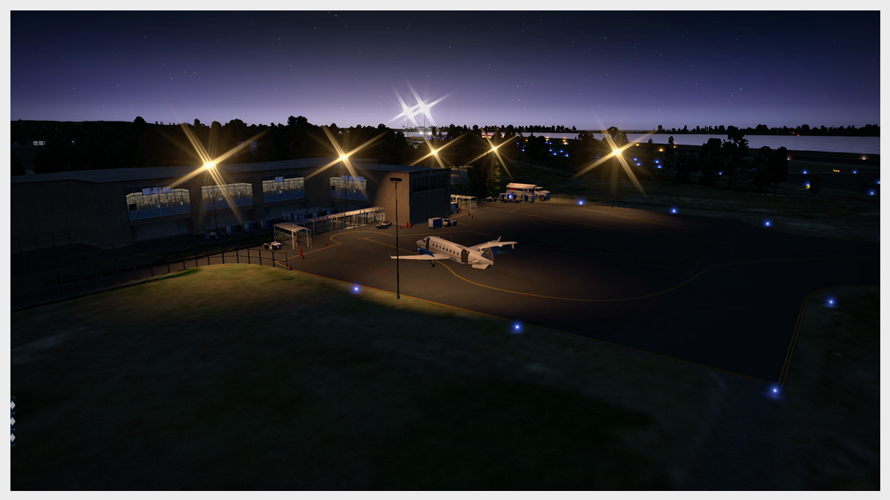
Die im Bild gezeigte Scenery beinhaltet weiterhin eine mit Ortho4XP generierte Phototapete und die Treelines and Farms von Alpilotx.
A adition to the X-Plane 10 autogen with the Europe Library of Simheaven. For X-Plane 11 the Europe Library is not necessary. It allows with little effort to make a resource saving scenery to run X-Plane on older computers smoothly.
The scenery adds throughout europe wind turbines and windmills, which can serve as reference points for visual flight. You need the current World Models for W2XP to run correctly.
The scenery shown in the picture further includes a photo wallpaper generated with Ortho4XP and Treelines and Farms of Alpilotx.
Happy flying
LyAvain
- 220 Downloads
-
Tampa Bay airport
USA FL KPIE St PETERSBURG-CLEARWATER INTL Airport HD v1.4
Not for XP10
Read the requirements or you will get error messages
Requirements: OpenSceneryX II. Not tested with Global Scenery.
RE_lib, CDB Library, The Handy Objects Library, R2_library, 3D_people_library
GALLERY
This file uses ©Marc Leydecker's library, his exclusive property.
The airport is on the west shoreline of Tampa Bay, six miles (10 km) north of St. Petersburg, Florida (the "birthplace of commercial air transportation"). Barely a decade after the pioneer flight of the Wright brothers at Kitty Hawk in 1903, the first tickets for airline travel were sold by the St. Petersburg-Tampa Airboat Line of Tony Jannus to fare-paying passengers. Using a Benoist XIV amphibious aircraft, the inaugural flight took place from a location near the downtown St. Petersburg Pier. Mayor Abram C. Pheil of St. Petersburg and Mae Peabody of Dubuque, Iowa, were the first passengers, flying across the bay to Tampa and, according to a United Press account, reportedly reaching the maximum speed of 75 miles per hour during the flight. Other reports indicate that they reached an altitude of 50 feet (15 m).
This marked the beginning of commercial air transportation anywhere in the world and is commemorated by a replica of the Benoist aircraft and a plaque at the airport terminal baggage claim area. Another replica is displayed at the St. Petersburg Museum of History adjacent to the Pier. Since 1991, the terminal holds the archives of the Florida Aviation Historical Society.
In September 2006, Allegiant Air announced significant scheduled service from St. Petersburg–Clearwater to destinations in Iowa, Illinois, Indiana, Michigan, Missouri, New York, Ohio, Pennsylvania, South Carolina, Tennessee, and Virginia. Since then, Allegiant has grown its destination count to and from PIE to 21 airports across the eastern U.S. In February, the Lansing, Michigan service shifted to Grand Rapids, Michigan, with four weekly flights.
Also, the airport recently completed a US$22 million renovation, including, among other things, expanding the gate sizes, new plumbing, and building loading bridges, as the current system requires all passengers to walk across the tarmac to the gate. These improvement played a significant roll in the airport luring passenger flights to and from the airport.
(Wiki) KPIE AIRNAV info SkyVector info GALLERY
Aknowledgments: Marc Leydecker, Cami De Bellis, 3D_people_library (DKM), Einstein (RE_Lib), R2_library, Helgo (Madagascar Trees), Kone Oneida (MowMyX-Plane), Autogate (Marginal) USAF vehicles (Austin)
- 221 Downloads
-
Welcome to Spain.
This is a set of new photoscenery that covers the entire country, mainland and islands.
Its main features are:
-100% free imagery and elevation data, from official sources.
-High definition mesh, generated from scratch with Meshtool 3 and official MDT25 elevation data (25meter resolution),
-High resolution imagery. Zoom level 17 on mainland and 18 on islands. Unlike Google's imagery that comes in compressed jpeg, our textures come from uncompressed GeoTiff sources, with only one stage of compression (DXT1), keeping a higher level of detail and sharpness.
-16bit unsigned DEMs with equalized histogram, with variable vertical resolution between a few millimetres and 6 centimetres. Main airports and several airfields have been handworked to keep slopes as real as possible.
-No visible watermarks on imagery.
-"Live" project. If needed, in the future we'll update the necessary files (usually only dsf,) if the underlying terrain of an airport or airfield needs to be fixed, or other possible errors such as gaps in the mesh or distorted textures. And who knows, perhaps we'll fix the chromatic differences between regions in the long term...
-Andras Fabian's (AlpilotX) autogen vectorial data extracted from HDMesh v3 (and UHD where available) with his kindly permission.
And what happens with France and Portugal?
-Sadly there's no free source of imagery (and elevation data) of both countries, so beyond the Spanish border there's only default terrain. There's no "continuity" with other photosceneries such SimHeaven or Zonephoto, due to the architecture of X-Plane Sceneries.
If you want to keep that "continuity" just don't install the border tiles, but expect differences in texture definition and mesh gaps within the line between tiles.
Andorra and Gibraltar are fully covered.
About inland water bodies; no X-Plane water has been used. Instead, we used transparent polygons extracted from CORINE, with the same physical properties as water. So you still can land on them with a seaplane. You won't see an "animated" water with reflections, but you will see the almost-real shape of dams and waterfalls. The official elevation data renders the inland water bodies flat, and the rivers should keep their slopes.
By clicking the Download button you will be redirected to an interactive map in our site with the download links. Don't worry, you'll find a Google Translate box in the right frame
Every tile or island group have 2 or 3 links:
DESCARGAR (Main download - High availability, hosted in our dedicated server)
MIRROR (Only some tiles - Medium availability, hosted in Dropbox Pro, limited to 200gb/day on total bandwitdh, if exceeded the links will be down for three days, we don't have control over this)
TORRENT (Low availability, the seeding is done by volunteers, the newest tiles are the slowest ones)
Inside every file you'll find a README.txt with installation instructions, credits and source notes.
Just unzip the content of each file into Custom Scenery and define them with lowest priority in your "scenery_packs.ini" or above any other mesh-based scenery (like HDMesh or SimHeaven's photosceneries)
The site of the project:
spainuhd.blogspot.com
(again, there's a Google Translate box in the right frame)
More info (spanish)
http://www.x-plane.e...p?topic=10061.0
http://www.x-plane.e...p?topic=10077.0
Orthographic photo and other data sources:
Mainland and Gibraltar orthophotos: PNOA, Instituto Geográfico Nacional de España . Canary Islands orthophotos: Ortoexpress, GRAFCAN . Balearic Islands orthophotos: IDEIB, Servei d'Informació Territorial de les Illes Balears . Andorra orthophotos: Govern d'Andorra . Spain elevation data - MDT25: Instituto Geográfico Nacional de España. Andorra elevation data - MDT15: Govern d'Andorra . Coast lines: OpenStreetMaps . Inland water bodies: Corine, IGN + European Environment Agency . Autogen vectorial data: Mesh HDV3 / UHD, Andras Fabian . A few notes:
- The overall size is about 330GB.
- 4GB VRAM and 8GB RAM recommended. Can work on systems with lower specs, but you'll need to sacrify some rendering options,
- Some small airports and airfields need the terrain to be fixed, We are working on it, eventually we'll publish small updates (usually only the DSF file)
- There are BIG chromatic differences between autonomous communities. We don't have any plans for now, this requires a lot of work and our free time is limited.
- No bathymetry. The current version of Meshtool don't support it. If a new version is released we'll rework the coastal tiles.
- SpainUHD comes from free sources, and it's made mainly with free and opensource tools, but hosting the files costs us money due its size. If you appreciate our efforts please consider a small donation (not mandatory )
Enjoy it
Albert Ràfols
José Ángel Estevez
Evaristo González
Jordi Duran
Juanjo Manzano
Pau Gómez
- 650 Downloads
-
This is a replication of a small dirt strip along the Amazonas in Brasil. Next bigger airports are Santarem (80nm) and Manaus (243nm). The airfield is suitable for all Single Prop Aircrafts and also for light Turboprops. The intention was to create an airfield for the Embraer 110 Bandeirante which has been there several times in real. Installation:Copy SJOH - Juruti Airport 1.X and SMSI_corrected into your Custom Scenery folder. If you have low framerate please check out the readme and copy the content of framerate improvements into vegetation. Required libraries:OpenSceneryX Features:Custom ObjectsGround Traffic AnimationsFlight Preperation room (press Shift+5)Lots of vegetation Thanks to yan_xp who did the scenery
- 73 Downloads
-
Installation:
Move the folder to “X-Plane 10/Custom Scenery/“ (Optional) Install OpenSceneryX 2.0.0 if you haven’t already. Get it at http://www.opensceneryx.com/ Features:
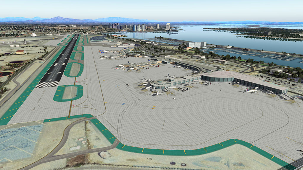
Photoreal scenery for the areas surrounding the airports Custom city buildings Detailed rendition of San Diego Lindberg Field International (KSAN)Accurate airport layout Custom models for all terminals, including the recently expanded Terminal 2 Custom high resolution taxiway and runway textures Animated Airport Vehicles Moving Jetways and Marshallers X-Plane 10 HDR Night Lighting Custom static aircraft, covering all major airlines operating from KSAN
GA airports McClellan-Palomar (KCRQ) and Montgomery Field (KMYF)
Requirements:X-Plane 10.30 (might work on older X-Plane 10 versions, not tested. X-Plane 9 not supported.) OpenSceneryX (no other Libraries needed) (Optional, but recommended) AutoGate by marginal for the moving jetways (Optional, but recommended) Alpilotx HD Mesh V2 2GB VRAM is recommended for running this scenery at extreme resolution
Compatibility:Generally, this scenery should be higher up in your scenery_packs.ini than other scenery packages “runways follow terrain contours“ works fine with this scenery and can be left on HD Mesh V2 by alpilotx - compatible, recommended San Diego Buildings by Brian Winton - FSX Conversion - compatible
Warning: Depending on your system, there may be a notable performance hit[*]KSAN San Diego International Airport 1.02 - compatible
Note: You can use that scenery for KNZY, KNRS, KNUC and KNFG.[*]San Diego Downtown Skyline 1.2 – not tested
Credits/Programs used:
[*]AutoGate and GroundTraffic by marginal
[*]GetGT from http://www.opalsky.com.au/
[*]WED 1.31 and X-Plane 10 by Laminar Research
[*]Blender 2.71 by the Blender Foundation
[*]Orthoimagery by the United States Geological Survey (USGS)
License:
USGS-authored or produced data and information are considered to be in the U.S. public domain.
Credit: U.S. Geological Survey
Department of the Interior/USGS
U.S. Geological Survey
http://www.usgs.gov/laws/info_policies.html
One or more textures in this airport have been created with images from CGTextures.com. These images may not be redistributed by default. Please visit http://www.cgtextures.com for more information.
You may not redistribute this scenery package.
KSAN_-_San_Diego.zip
- 522 Downloads
-
USA FLORIDA KTPA Tampa Intl Airport v1.0
One month of full time work.
Everything NAPS usually offers but terminals.
Requirements OpenSceneryX II, CDB lib.
I use it as a platform for personal scenery.
You may not redistribute, nor modify © USA FLORIDA KTPA Tampa Intl Airport by NAPS.
Airport integrated in existing scenery & road network, detailed roadways, taxiways, centerlines, taxiway signs (296!), pavement signage, signage, NAV utilities, equipment, sim's integration, landscaping, lights, satellite imagery (courtesy USGS), etc.
ATC traffic.
Includes elements of Marc Leydecker's © Library.
- 293 Downloads
-
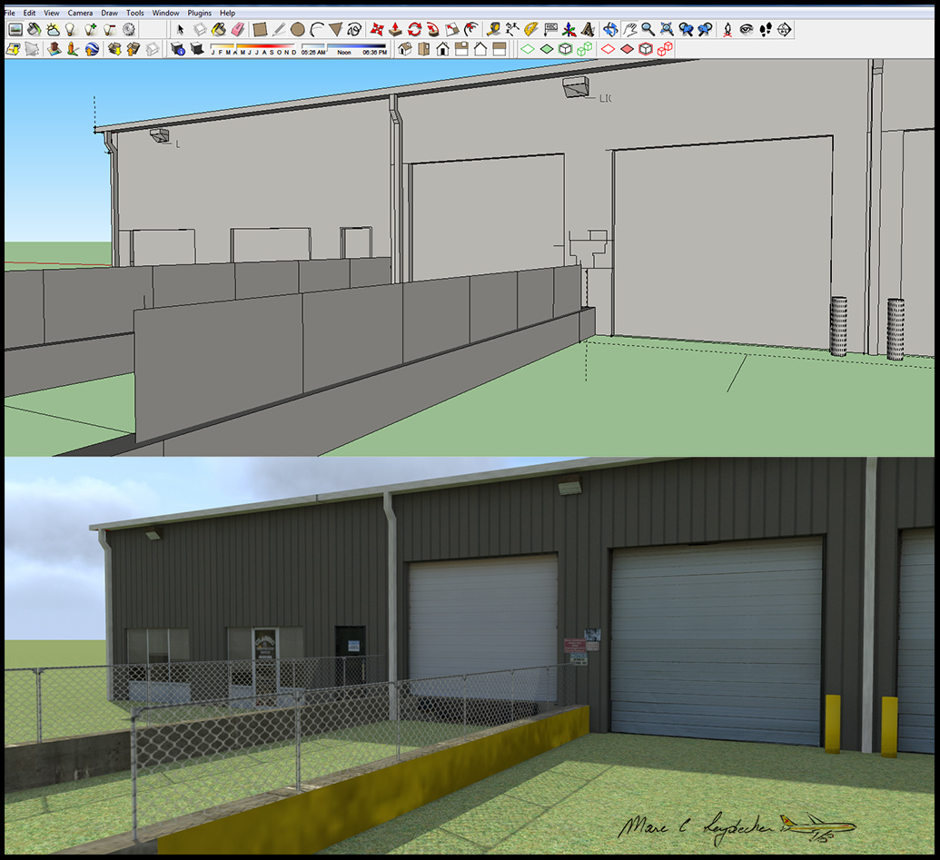
On behalf of Marc Leydecker aka Belga12345, Aerosoft isp leased to offer you his latest SketchUp tutorial.
I got a ton of emails from members asking help on creating photo-realistic airports
So attached is a mini tutorial in PDF
Remember, the key is patience and weathered textures!
How it started (with some more texture hints)
http://www.flightsim.com/vbfs/content.php?15734-Interview-With-Marc-Leydecker
Interview with Areosoft
http://asn-xp.aerosoft.com/?page_id=10151
KFYJ review (lots of pictures)
http://asn-xp.aerosoft.com/?page_id=12765
KPVG review (lots of pictures)
http://asn-xp.aerosoft.com/?page_id=10576
Enjoy,
Marc
Please do not forget to vote
- 155 Downloads
-
4 months of full time work
In preparation: PHASE 3: SRQ SARASOTA DOWNTOWN, BRADENTON, LAKEWOOD RANCH & BEACHES
Brand new airport made from scratch. Adjusted, tweaked orthos, many new authentic buildings based upon actual photography; aprons, taxis, roads with edges; new service roads and roads concept using smooth .lin files, tire marks, aircraft stains; attention to details, gazillions of objects in the exact right place, but still with the NAPS' signature.
Team
Freddy De Pues (frede, LeBaron), airport developper.
Marc Leydecker, advisor, ©Library, exclusive property of Marc Leydecker.
Fabrice Kauffmann, ©F-35B static aircraft library, exclusive property of Fabrice Kauffmann. (version 1.0)
Farrell Brown, flight instructor @ SRQ, accurate photos, reality checks.
Albert Van Thournout, retired BAF & SABENA pilot, consultant, technical issues and reality checks.
Features
Customized buildings + OpenScenery
Orthoimagery courtesy of USGS with gritting textures. Polygons follow airport boundaries.
Optimized polys and objects for better FPS.
Airport integrated in existing scenery & road network, detailed roadways, taxiways, centerlines, pavement signage, signage, equipment, sim's integration, landscaping, lights, 3D people, animations, etc.
Autogate
ATC traffic & flows.
Requirements: OpenSceneryX II, CDB Library, The Handy Objects Library, 3D_People_Library, Flags of USA States, world-models-masters, RE_Library, RuScenery.
GALLERY & SLIDESHOW (50 pix)
Version 1.0 with the F-35B Airshow is still available.
More on FRED-E.NET with acknowledgments to lib & plugin creators.
- 191 Downloads
-
Installation:
Copy the „KPHX – Phoenix Sky Harbor Intl“ folder (not the main folder!) into your „X-Plane 10/Custom Scenery“ folder.
Afterwards, always make sure that this scenery package has higher priority in your scenery_packs.ini than "Global Airports", "HD Mesh", or other scenery packages for the Phoenix area.
Features:
Accurate 3D models for all major buildings
Accurate airport layout
Photoreal scenery for the airport area
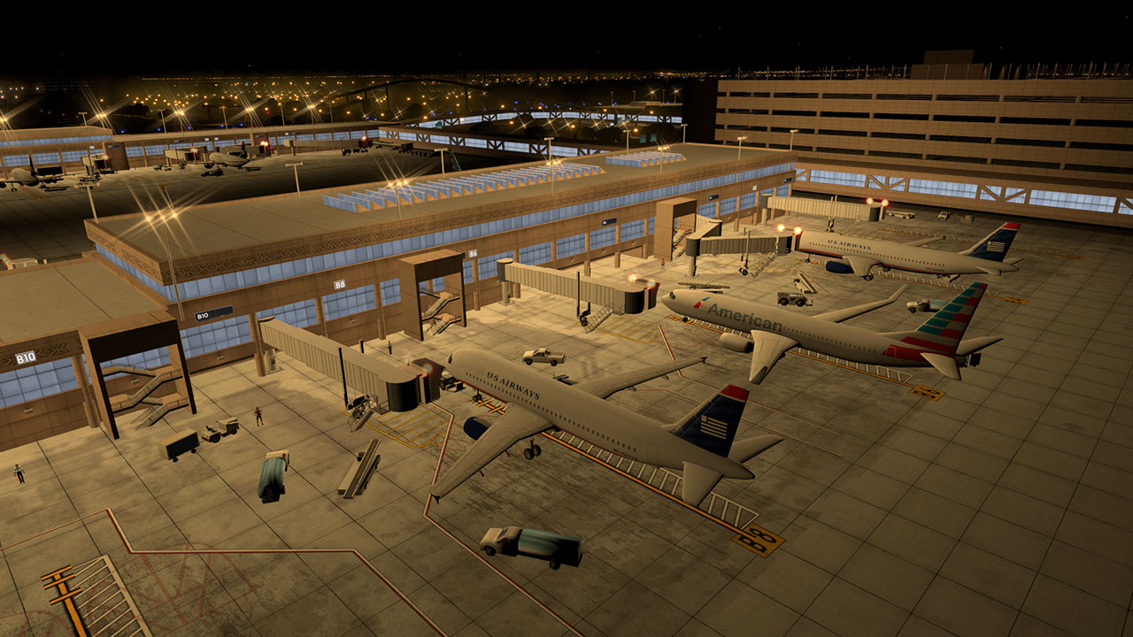
Animated airport vehicles and SkyTrain
Animated 3D people
Animated Jetways and Marshallers
HDR night lighting
Static aircraft
Requirements:X-Plane 10.30+
(Optional) AutoGate to use moving jetways/marshallers
(Optional) HD Mesh V3 to make the surroundings look better
Credits/Programs used:
[*]GetGT by AndrooC
[*]XPL TaxiSign Generator by X-Design CSD
[*]World Editor 1.31 by Laminar Research
[*]Blender 2.74 by the Blender Foundation
[*]AutoGate and GroundTraffic by marginal
[*]Orthoimagery by the United States Geological Survey (USGS)
License:
This scenery package is for personal, non-commercial use only.
Redistributing this scenery or any part of it is prohibited.
For further information, feel free to contact me.
- 421 Downloads
-
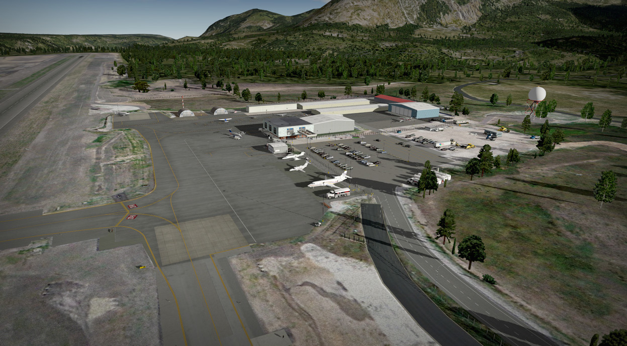
Features:
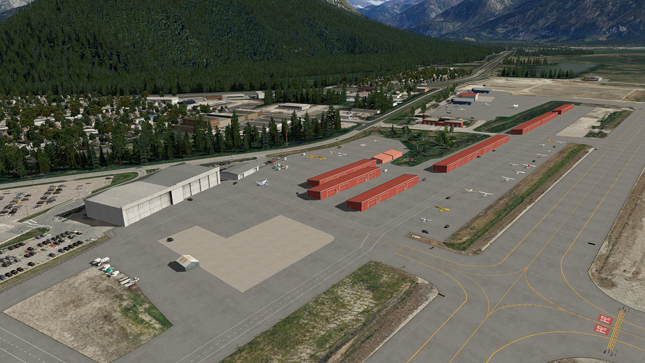
Photoreal scenery for the area surrounding the airport
Detailed rendition of Juneau International Airport(PAJN)Animated 3D people
Animated airport vehicles
Custom approach lead-in lighting (LDIN)
Accurate airport layout
Custom models for terminals and hangars
Custom high resolution taxiway textures
Moving jetways and marshallers
X-Plane 10 HDR night lighting
Requirements:X-Plane 10.30 (might work on older X-Plane 10 versions, not tested. X-Plane 9 not supported.)
OpenSceneryX (no other libraries needed)
(Optional, but recommended) AutoGate by marginal for the moving jetways
(Optional, but recommended) Alpilotx HD Mesh V2
Installation:
[*]Move the folder to “X-Plane 10/Custom Scenery/“
[*](Optional) Install OpenSceneryX 2.0.0 if you haven’t already. Get it at http://www.opensceneryx.com/
Credits/Programs used:
[*]AutoGate and GroundTraffic by marginal
[*]GetGT from http://www.opalsky.com.au/
[*]WED 1.31 and X-Plane 10 by Laminar Research
[*]Blender 2.71 by the Blender Foundation
[*]Orthoimagery by the United States Geological Survey (USGS)
License:
USGS-authored or produced data and information are considered to be in the U.S. public domain.
Credit: U.S. Geological Survey
Department of the Interior/USGS
U.S. Geological Survey
http://www.usgs.gov/laws/info_policies.html
One or more textures in this airport have been created with images from CGTextures.com. These images may not be redistributed by default. Please visit http://www.cgtextures.com for more information.
You may not redistribute this scenery package.
- 218 Downloads
-
Installation:
Move all three folders to “X-Plane 10/Custom Scenery/“
Install OpenSceneryX 2.0.0 if you haven’t already. Get it at http://www.opensceneryx.com/
(Optional) If you own the "Golden Gate and South Bay" payware, also download the compatibility patch to resolve issues with duplicate bridges.
(Optional) Install AutoGate to get moving jetways
(Optional) Install alpilotx' HD Mesh V2
You can install the "Alternative non-hard bridges" file to be able to fly under the bridges, at the cost of removing the car traffic on them. You can find them in "KSFO-San Francisco/Optional files".
Features:
Photoreal scenery for the San Francisco City area
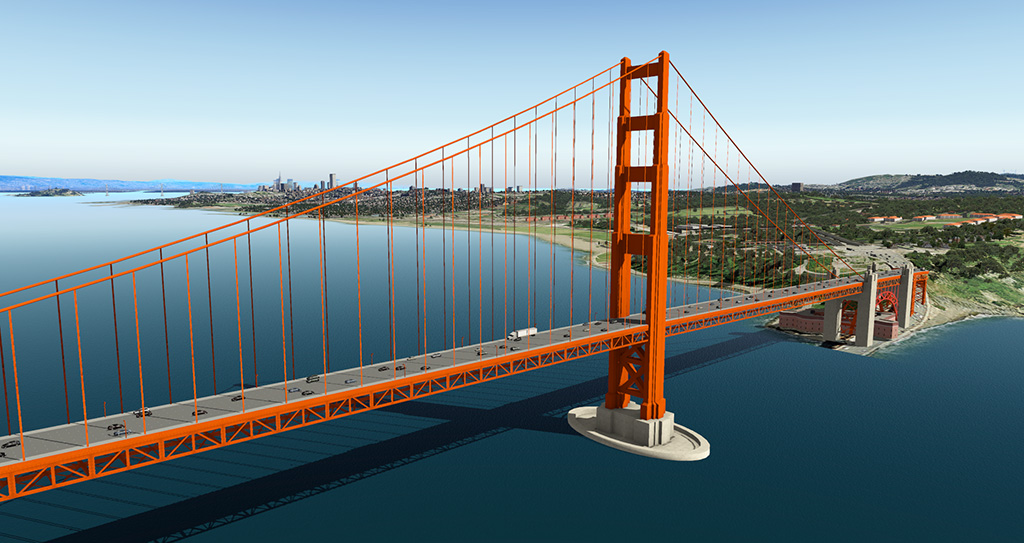
Detailed models of the famous Golden Gate Bridge as well as the Oakland Bay Bridge, including street lights at night and animated car traffic
Several skyscrapers, including the Transamerica Pyramid
Alcatraz
Detailed rendition of the San Francisco International Airport (KSFO)Accurate airport layout
Custom models for all terminals
Custom taxiway and runway textures
Animated AirTrain and Airport Vehicles
Moving Jetways and Docking Guidance System
X-Plane 10 HDR Night Lighting
Static aircraft
Optional version without static aircraft available for online users
Credits/Programs used:
[*]AutoGate and GroundTraffic by marginal. Really brings the airport to life
[*]GetGT from http://www.opalsky.com.au/ Makes setting up GroundTraffic Routes easier
[*]XPL-TaxiSign Generator by X-Design CSD. The main reason why this scenery won‘t fill your log.txt with taxi sign syntax errors
[*]WED 1.31 and X-Plane 10 by Laminar Research
[*]Blender 2.71 by the Blender Foundation
[*]Orthoimagery by the United States Geological Survey (USGS)
License:
USGS-authored or produced data and information are considered to be in the U.S. public domain.
Credit: U.S. Geological Survey
Department of the Interior/USGS
U.S. Geological Survey
http://www.usgs.gov/laws/info_policies.html
One or more textures in this airport have been created with images from CGTextures.com. These images may not be redistributed by default. Please visit http://www.cgtextures.com for more information.
You may not redistribute this scenery package.
- 678 Downloads
-
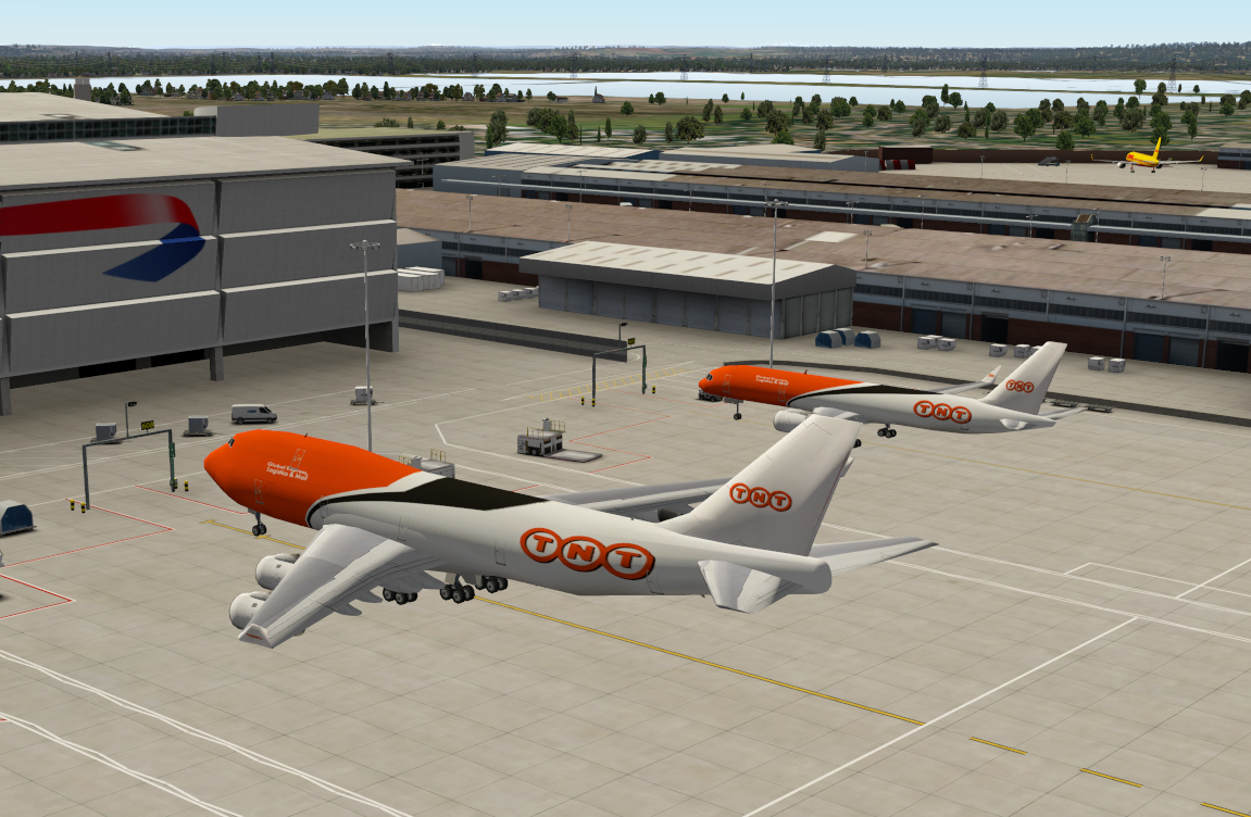
This file adds static airplanes to our London Heathrow scenery -> http://en.shop.aerosoft.com/eshop.php?action=article_detail&s_supplier_aid=13401&s_design=DEFAULT&shopfilter_category=Flight%20Simulation&s_language=english
You have to install London Heathrow and OpenSceneryX first and be sure that “_StaticAirplanes London-Heathrow” is above “Aerosoft - EGLL Airport London-Heathrow” in your scenery_packs.ini
Diese Scenery bringt Ihnen statische Flugzeuge für unsere London Heathrow Scenery -> http://www.shop.aerosoft.com/eshop.php?action=article_detail&s_supplier_aid=13401&s_design=DEFAULT&shopfilter_category=Flight%20Simulation&s_language=german
Stellen Sie sicher, dass Sie zuerst den Flughafen und OpenSceneryX installiert haben und das “_StaticAirplanes London-Heathrow” in der scenery_packs.ini über “Aerosoft - EGLL Airport London-Heathrow” steht.
- 1841 Downloads
-
Requirements: OpenSceneryX II, 3D_people_library. What's new in version 3.0? New DKM 3D people. GALLERY
- 219 Downloads
-
GALLERY Requirements: OpenSceneryX II, 3D_people_library. Not tested with Global Airports. Delete previous versions of PHHN.
- 201 Downloads
-
Refueling air base in Florida (282MB) Made for extreme rez, not tested with Global Airports.
GALLERY
MOVIE
- 108 Downloads
-
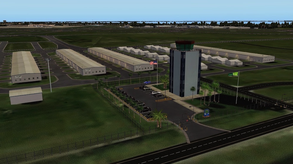
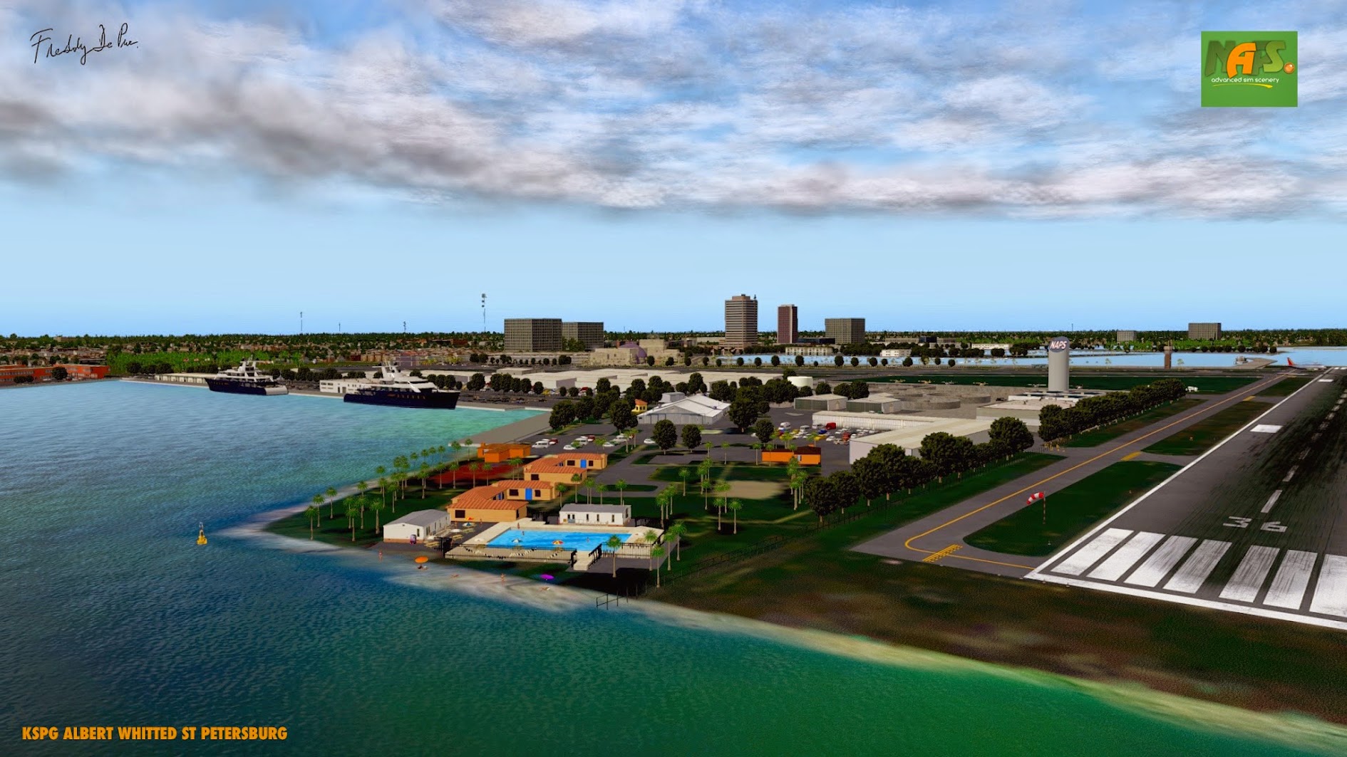
Aerosoft is please, in consult with Freddy De Pues from Fred-E.Net to offer you Albert Whitted Airport St Petersburg HD (KSPG) version 1.0
This file uses ©Marc Leydecker's library, his exclusive property. Further on .... ATC traffic, customized buildings, USGS satellite images, tropical waters, waves, animations, etc.
Airport Background Information:
In October 2007, the City completed construction on a $4,000,000-10,600 sq/ft terminal building. The terminal also has a 12,200 sq/yd aircraft parking ramp and a 64-space parking lot. The terminal houses the airport's Fixed Base Operator (FBO) and other various aviation and retail tenants. The Hangar Restaurant and Flight Lounge opened on the 2nd floor of the terminal in April 2010. In 2008, the city opened Albert Whitted Park, which is located on the north side of the airport. The park has observation areas overlooking the airport and an aviation themed playground. The Park is open for the general public's enjoyment, but can be reserved for special functions. A new $3 million control tower is operational. A new Taxiway D on the northside and parallel to Runway 7-25 funded by the FAA is operational. This taxiway connects the terminal building with Runways 18 and 25.
Since 2003, capital improvements have totaled over $11 million. (Courtesy of Wikipedia))
Acknowledgements:
- Marc Leydecker,
- Cami De Bellis,
- Giant 551 (Yacht),
- Altair (People),
- FlyByGuy (The Handy Man),
- Ruscenery,
- Einstein (RE_Lib),
- ChrisLec (Wave Animation),
- Chris Noe (Flags of The World),
- Helgo (Madagascar Trees),
- Kone Oneida (MowMyX-Plane),
- SeaPlaneDocks (?).
- 236 Downloads
-
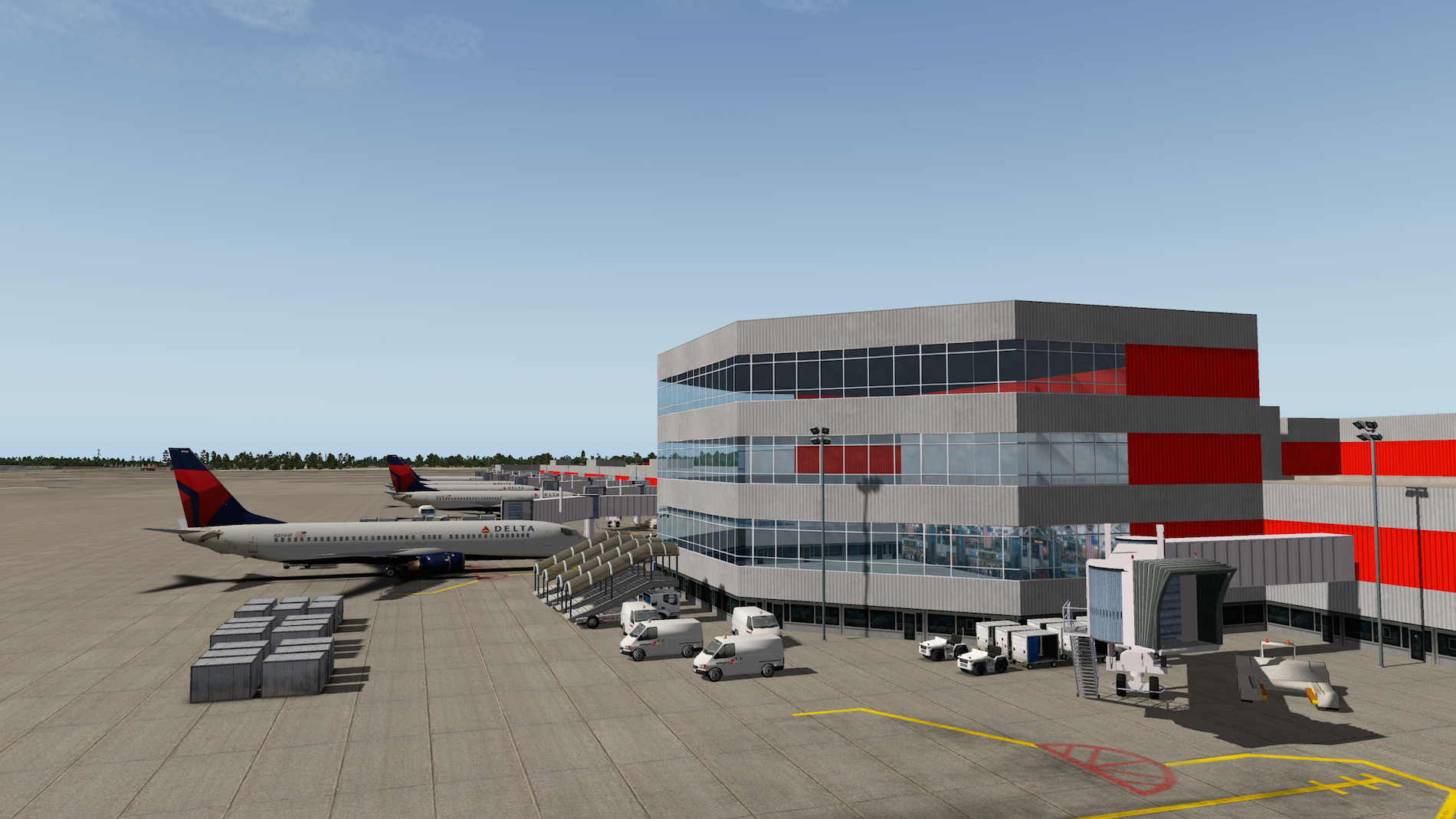
Aerosoft is pleased to offer you, on behalf of Freddy De Pues from Fred-E.Net, Hartsfield-Jackson Atlanta International Airport (KATL) version 1.2.
Airport background Information:
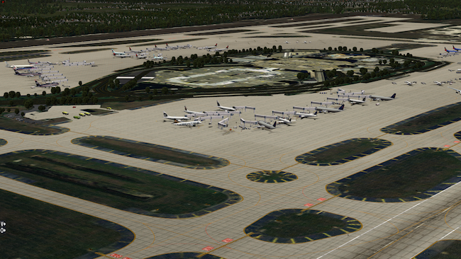
Hartsfield–Jackson Atlanta International Airport (IATA: ATL, ICAO: KATL, FAA LID: ATL), known locally as Atlanta Airport, Hartsfield, or Hartsfield–Jackson, is located seven miles (11 km) south of the central business district of Atlanta, Georgia, United States. It has been the world's busiest airport by passenger traffic since 1998, and by number of landings and take-offs since 2005. Hartsfield–Jackson held its ranking as the world's busiest airport in 2012, both in passengers and number of flights, by accommodating 95 million passengers (more than 260,000 passengers daily) and 950,119 flights. Many of the nearly one million flights are domestic flights from within the United States, where Atlanta serves as a major hub for travel throughout the Southeastern United States. The airport has 207 domestic and international gates.
Hartsfield–Jackson International Airport is a focus city for Southwest Airlines and is the primary hub of Delta Air Lines and Delta Connection partner ExpressJet; at nearly 1,000 flights a day, the Delta hub is the world's largest airline hub Delta Air Lines flew 59.01% of passengers from the airport in February 2011, AirTran flew 17.76%, and ExpressJet flew 13.86%. In addition to hosting Delta's corporate headquarters, Hartsfield–Jackson is also the home of Delta's Technical Operations Center, which is the airline's primary maintenance, repair and overhaul arm. The airport has international service to North America, South America, Central America, Europe, Asia and Africa. As an international gateway to the United States, Hartsfield–Jackson ranks sixth. (Courtesy Wikipedia)
Requirements:
- OpenSceneryX II
- Don't use with Global Scenery or disable it in the .ini file.
- 344 Downloads
-
Aerosoft is pleased to offer you on behalf of Freddy De Pues from NAPS, Kona International At Keahole Airport (PHKO) in HD quality. Exclusive screenshots can be found at ASN.
The team consist of:
- Freddy De Pues (frede), apt.dat, dsf, traffic, orthos, customized buidings.
- Marc Leydecker, Library. Exclusive property of Marc Leydecker.
The airport comes with the following features:
- Customized buildings + OpenScenery.
- ATC traffic
Background Airport Information:
Kona International at Keahole Airport covers 2,700 acres (1,100 ha) at an elevation of 47 feet (14 m) above mean sea level. It has one asphalt runway, 17/35, 11,000 by 150 feet (3,353 x 46 m). The state government of Hawaiʻi facility operates a runway and a terminal complex of single story buildings along the eastern edge of the airfield for passengers, air cargo and mail, airport support, and general aviation.
Kona International is the only remaining major airport in the Hawaiian Islands where a mobile ramp is used to plane and deplane passengers. Kona International sees daily 717, 737, 757, 767, and 777 aircraft, as well as smaller inter-island aircraft, and general private aviation. The airport terminal is a rambling, open-air set of structures. Long after other airports in Hawaiʻi converted their terminals to multi-story buildings with automated jetway systems, Hawaiian Airlines could still utilize their DC-9 fleet's tailcone exits at Kailua-Kona. An environmental impact statement was prepared in 2005 to add a second runway. The United States Air Force investigated building a second 3,950 ft (1,200 m) runway in 2009. This would be used for practicing landing C-17 military cargo planes on a short runway.[12] Although the 11,000 ft (3,353 m) runway allows flights to Japan and Chicago, it is the only major airport in Hawaii with a single runway. (Courtesy of Wikipedia)
Thank you freeware and donation ware librarians.
- 379 Downloads
-
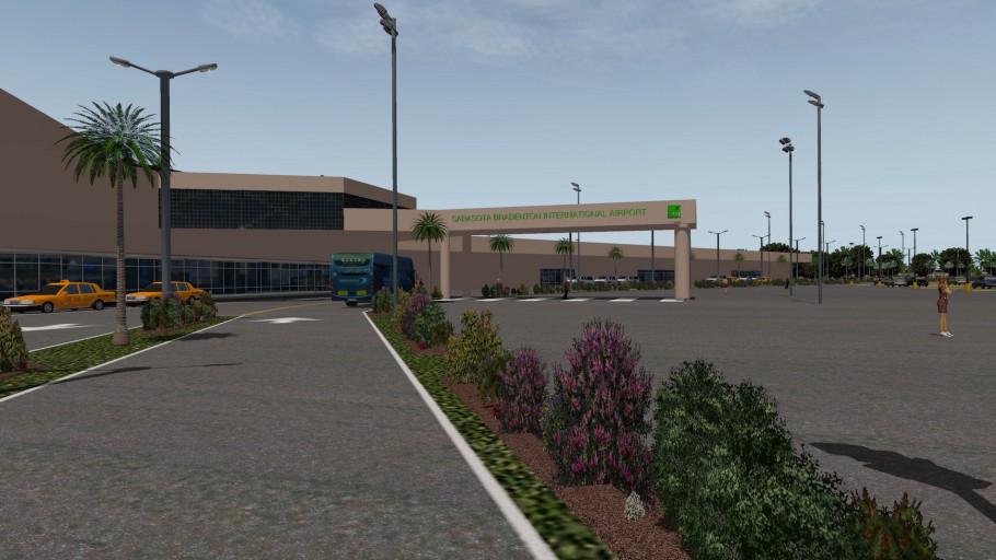
Aerosoft is pleased to offer you on behalf of Freddy De Pues from NAPS, Sarasota-Bradenton International Airport (KSRQ) in HD quality. Exclusive screenshots can be found at ASN.
The team consist of:
- Freddy De Pues (frede), apt.dat, dsf, traffic, orthos, customized buidings.
- Marc Leydecker, Library. Exclusive property of Marc Leydecker.
- Fabrice Kauffmann, F-35B static aircraft library. Exclusive property of Fabrice Kauffmann.
The airport features:
- Customized buildings + OpenScenery
- USGS orthoimagery with gritting textures, polygons follow airport boundaries. Empirical placement of JP2 tiles.
- Optimized polys and objects for better FPS.
- Airport integrated in existing scenery & road network, detailed roadways, taxiways, centerlines, pavement signage, signage, equipment, sim's integration, landscaping, lights, 3D people, animations, etc.
- Autogate
- ATC traffic
Background airport information:
Sarasota–Bradenton International Airport (IATA: SRQ[2], ICAO: KSRQ, FAA LID: SRQ) is a public airport in Sarasota County (terminal) and Manatee County (airfield), Florida. Owned by the Sarasota Manatee Airport Authority, it is three miles north of Sarasota (Sarasota County)[1] and six miles south of Bradenton (Manatee County).
The National Plan of Integrated Airport Systems for 2011–2015 called it a primary commercial service airport since it has over 10,000 passenger boardings per year. Federal Aviation Administration records say the airport had 657,157 enplanements in calendar year 2011, 2% less than in 2010.
Most airlines refer to the airport on destination maps and flight status displays as just "Sarasota", as that is the more widely known city. The airport is referred to locally as "SRQ" (the airport code). Much of the airport's airline service occurs during winter and spring, as the area is a popular tourist destination and home for snowbirds during winter and spring. The airport's IATA airport code, "SRQ", is used as a shorthand nickname for the city of Sarasota and Sarasota area in general, as exemplified by media outlets like SRQ Magazine, WSRQ radio, and numerous local businesses in the area that include SRQ in their names. (Courtesy of Wikipedia)
Thank you freeware and donation ware librarians. Thanks Mow My XP, People by Altair, Tacan by JP.
- 286 Downloads
-
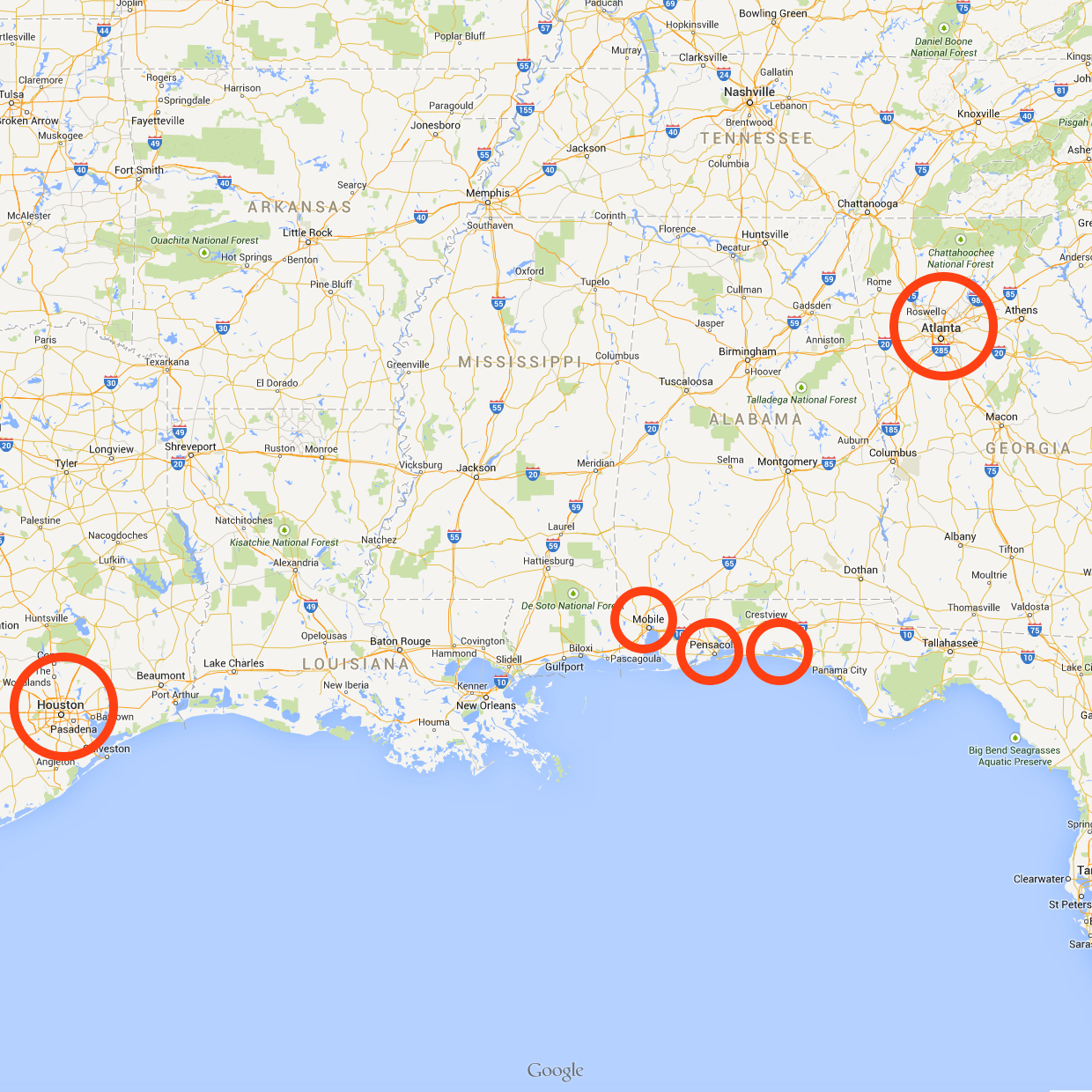
Aerosoft is pleased to offer you on behalf of Freddy De Pues from NAPS, NAS Pensacola Forrest Sherman Field (KNPA) in HD quality. A comprehensive review can be found at ASN.
APA 42 TS file: this file eliminates an unnecessary rotating beacon.
Background information KIAH:
George Bush Intercontinental Airport, (IATA: IAH, ICAO: KIAH, FAA LID: IAH)[3] is a Class B international airport in Houston, Texas serving the Greater Houston metropolitan area, the fifth-largest metropolitan area in the United States. Located about 23 miles (37 km) north of Downtown Houston,[3] between Interstate 45 and Interstate 69/U.S. Highway 59, George Bush Intercontinental Airport has scheduled flights to domestic and international destinations. The airport is named after George H. W. Bush, the 41st President of the United States.
George Bush Intercontinental Airport served 40,187,442 passengers[5] in 2011 making the airport the tenth busiest for total passengers in North America. In 2006, the airport was named the fastest-growing of the top ten airports in the United States by the United States Department of Transportation. Houston Bush Intercontinental is the largest passenger carrying hub for United Airlines carrying 16.6 million passengers annually with an average of 45,413 passengers daily. The airport also serves as focus city for Spirit Airlines.
The site for Bush Intercontinental Airport was originally purchased by a group of Houston businessmen in 1957 to preserve the site until the city of Houston could formulate a plan for a second airport, supplanting what was then known as Houston Municipal Airport (later renamed William P. Hobby Airport). The holding company for the land was named the Jet Era Ranch Corporation, but a typographical error transformed the words "Jet Era" into "Jetero" and the airport site subsequently became known as the Jetero airport site. Although the name Jetero was no longer used in official planning documents after 1961, the eastern entrance to the airport was named Jetero Boulevard. Most of Jetero Boulevard was subsequently renamed Will Clayton Parkway.
The City of Houston annexed the Bush Airport area in 1965. This annexation, along with the 1965 annexations of the Bayport area, the Fondren Road area, and an area west of Sharpstown, resulted in a total gain of 51,251 acres (20,741 ha) of land for the city limits.
George Bush Intercontinental Airport served 40,187,442 passengers[5] in 2011 making the airport the 10th busiest for total passengers in North America. IAH is the 7th largest international passenger gateway in the US[3] and the 7th busiest airport in the world for total aircraft movements. In 2006, the United States Department of Transportation named George Bush Intercontinental Airport the fastest growing of the top ten airports in the United States.[24] The Houston Airport System (HAS) states that the airport's service area includes the following Greater Houston counties: Brazoria, Chambers, Fort Bend, Galveston, Harris, Liberty, Montgomery, and Waller. The airport currently ranks fourth in the United States for non-stop domestic and international service with 182 destinations and about 45 percent of the airport's passengers begin or terminate (O&D) their journey at the airport. Bush Intercontinental ranks first among the major United States airports with the highest on-time performance, according to a 2010 United States Department of Transportation report. As of 2007, with 31 destinations in Mexico, the airport offers service to more Mexican destinations than any other United States airport.
The Houston Air Route Traffic Control Center, located on the airport grounds at 16600 JFK Boulevard, serves as the region's ARTCC. The HAS administrative offices are also on the airport property. (Courtesy of Wiki)
First Airport with Cami De Bellis.
Acknowledgements:
OpenSceneryX II, Ben Supnik, Marc Leydecker Libraries, RuScenery, Cami De Bellis library
- 1175 Downloads
-
Aerosoft is pleased to offer you on behalf of Freddy De Pues from NAPS, Mobile Regional (KMOB).
Background information KMOB:
Mobile Regional Airport (IATA: MOB, ICAO: KMOB, FAA LID: MOB) is a public and military use airport located 11 nautical miles (20 km) west of Mobile, a city in Mobile County, Alabama, United States. It is near Pascagoula, Mississippi. The airport, owned and operated by the Mobile Airport Authority] is an independent, self-funded entity that receives no local tax dollars.
It is included in the National Plan of Integrated Airport Systems for 2011–2015, which categorized it as a primary commercial service airport. As per Federal Aviation Administration records, the airport had 286,956 passenger boardings (enplanements) in calendar year 2008,[3] 280,491 enplanements in 2009, and 277,232 in 2010.
The airport is also home to U.S. Coast Guard Aviation Training Center Mobile, providing advanced training to U.S. Coast Guard pilots and aircrew in HH-65 Dolphin and HH-60 Jayhawk helicopters as well as HU-25 Guardian jets and HC-144 Ocean Sentry turboprop aircraft. The Alabama Army National Guard's 1st Battalion, 131st Aviation Regiment's "B" Company is also located at the airport.
United Airlines via United Express previously served Mobile from its hubs in Chicago (ORD) and Washington D.C. (IAD). However, following the September 11, 2001 attacks, United canceled all service and withdrew from Mobile. United Express has since reinstated nonstop service to Chicago and also flies nonstop to Houston (IAH) following the merger of United with Continental Airlines. Regional jets are operated on all United Express flights serving Mobile. In 2006 Delta Air Lines dropped several flights from Mobile and Continental Airlines added flights. In December 2006 Delta had six weekday flights to Atlanta and one to its Cincinnati hub. Delta ended service to Cincinnati on December 12, 2006. American Airlines restored flights to Chicago (ORD) in April 2007 but ended them in September 2008. Flights to Dallas/Ft. Worth (DFW) continue on its American Eagle regional airline affiliate via the use of Embraer ERJ regional jet aircraft.
In 2010 Northwest Airlines merged into Delta Air Lines. Northwest had operated nonstops from Mobile to its hub in Memphis (MEM); those flights ended following the merger with Delta. After its merger with Continental Airlines in 2012 United Airlines (via its United Express regional affiliate operated by Express Jet) resumed flights to its hub in Houston (IAH), seven weekday flights. United Express also resumed service to the United hub in Chicago (ORD) on April 9, 2013. US Airways via its US Airways Express affiliates continue nonstop flights to the US Airways hub in Charlotte (CLT). (Courtesy of Wikipedia)
Mobile Downtown: I had a good time creating the USCG school. Hans did a great job with the terminal.
Acknowledgements:
OpenSceneryX II, Ben Supnik and RuScenery
- 113 Downloads
-
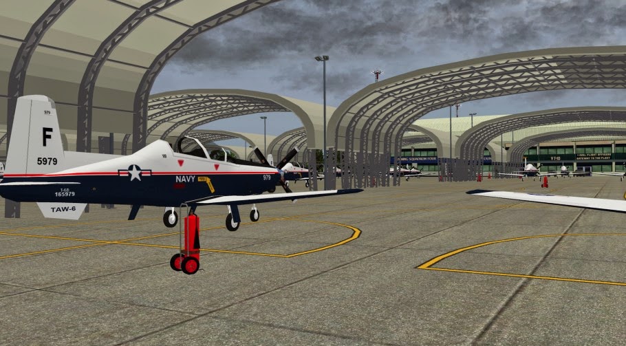
Aerosoft is pleased to offer you on behalf of Freddy De Pues from NAPS, NAS Pensacola Forrest Sherman Field (KNPA) in HD quality. A comprehensive review can be found at ASN.
The NAPS team consist of:
- Freddy De Pues (frede), USA, apt.dat, dsf, traffic, orthos.
- Hans H Gindra (Wheelie), Germany, customized buildings.
- Marc Leydecker, Library.
- Cami De Bellis, Library.
- Brian Godwin, ATC.
- Fabrice Kauffmann, static aircraft.
The airport comes with the following features:
- Customized buildings + OpenScenery
- USGS orthoimagery with gritting textures, polygons follow airport boundaries
- Optimized polys and objects for better FPS.
- Airport integrated in existing scenery & road network, detailed roadways, taxiways, centerlines, pavement signage, signage, equipment, sim's integration, landscaping, lights, etc.
- Autogate
- ATC traffic
- Ground Traffic
Background information KNPA:
Naval Air Station Pensacola or NAS Pensacola (IATA: NPA, ICAO: KNPA, FAA LID: NPA) (formerly NAS/KNAS until changed circa 1970 to allow Nassau International Airport, now Lynden Pindling International Airport, to have IATA code NAS), "The Cradle of Naval Aviation", is a United States Navy base located next to Warrington, Florida, a community southwest of the Pensacola city limits. It is best known as the initial primary training base for all Navy, Marine and Coast Guard aviators and Naval Flight Officers, the advanced training base for most Naval Flight Officers, and as the home base for the United States Navy Flight Demonstration Squadron, the precision-flying team known as the Blue Angels. Because of contamination by heavy metals and other hazardous materials during this history, it is designated as a Superfund site needing environmental cleanup.
The air station also hosts the Naval Education and Training Command (NETC) and the Naval Aerospace Medical Institute (NAMI), which provides training for all naval flight surgeons, aviation physiologists, and aviation experimental psychologists. With the closure of Naval Air Station Memphis in Millington, Tennessee and the transition of that facility to Naval Support Activity Mid-South, NAS Pensacola also became home to the Naval Air Technical Training Center (NATTC), providing technical training schools for nearly all enlisted aircraft maintenance and enlisted aircrew specialties in the U.S. Navy, U.S. Marine Corps and U.S. Coast Guard.
NAS Pensacola contains Forrest Sherman Field, home of Training Air Wing SIX, providing undergraduate flight training for all prospective Naval Flight Officers for the U.S. Navy and U.S. Marine Corps, and flight officers/navigators for other NATO/Allied/Coalition partners. TRAWING SIX consists of the Training Squadron 4 (VT-4) Warbucks, Training Squadron 10 (VT-10) Wildcats and Training Squadron 86 (VT-86) Sabrehawks, flying the T-45C Goshawk, T-6A Texan II and T-39 Sabreliner aircraft.
A select number of prospective U.S. Air Force Navigator/Combat Systems Officers, destined for certain fighter and bomber aircraft, were previously trained via TRAWING SIX, with command of VT-10 rotating periodically to a USAF officer. Today, all USAF Undergraduate CSO Training (UCSOT) for all USAF aircraft is consolidated at NAS Pensacola as a strictly USAF organization and operation under the 479th Flying Training Group (479 FTG), an Air Education and Training Command (AETC) unit. The 479 FTG is a tenant activity at NAS Pensacola and a geographically separated unit (GSU) of the 12th Flying Training Wing (12 FTW) at Randolph AFB, Texas. The 479 FTG operates USAF T-6A Texan II and T-1A Jayhawk aircraft.
Other tenant activities include the United States Navy Flight Demonstration Squadron, the Blue Angels, flying F/A-18 Hornets and a single USMC KC-130F Hercules; and the 2nd German Air Force Training Squadron USA (German: 2. Deutsche Luftwaffenausbildungsstaffel USA – abbreviated "2. DtLwAusbStff"). A total of 131 aircraft operate out of Sherman Field, generating 110,000 flight operations each year.
The National Naval Aviation Museum (formerly known as the National Museum of Naval Aviation), the Pensacola Naval Air Station Historic District, the National Park Service-administered Fort Barrancas and its associated Advance Redoubt, and the Pensacola Lighthouse and Museum (see Pensacola Light) are all located at NAS Pensacola, as well as Barrancas National Cemetery.
The site now occupied by NAS Pensacola has been controlled by varying nations. In 1559, Spanish explorer Don Tristan de Luna founded a colony on Santa Rosa Island, considered the first European settlement of the Pensacola area. The Spanish built the wooden Fort San Carlos de Austria on this bluff in 1697-1698. Although besieged by Indians in 1707, the fort was not taken. Spain was competing in North America with the French, who settled lower Louisiana and the Illinois Country and areas to the North. The French destroyed this fort when they captured Pensacola in 1719. After Great Britain defeated the French in the Seven Years' War and exchanging some territory with Spain, British colonists took over this site and West Florida in 1763.
In 1781, as an ally of the American rebels during the American Revolutionary War, the Spanish captured Pensacola. Britain ceded West Florida to Spain following the war. The Spanish completed the fort San Carlos de Barrancas in 1797.[2][3] Barranca is a Spanish word for bluff, the natural terrain feature that makes this location ideal for the fortress.
Pensacola was taken by General Andrew Jackson in November 1814 during the War of 1812 between Great Britain and the United States. British forces destroyed Fort San Carlos as they swept through the area. The Spanish remained in control of the region until 1821, when the Adams-Onís Treaty confirmed the purchase of Spanish Florida by the United States, and Spain ceded this territory to the US.
In 1825, the US designated this area for the Pensacola Navy Yard was designated and Congress appropriated $6,000 for a lighthouse. Operational that year, it "is said to be haunted by a light keeper murdered by his wife."[4] Fort Barrancas was rebuilt, 1839-1844, the U.S. Army deactivating it on 15 April 1947. Designated a National Historic Site (NHL) in 1960, control of the site was transferred to the National Park Service in 1971. After extensive restoration during 1971-1980, Fort Barrancas was opened to the public. It has a visitor's center. (Courtesy of WikiPedia)
NAS Pensacola is one of my favorite destinations!
Acknowledgements:
OpenSceneryX II, Ben Supnik, Marc Leydecker Libraries, RuScenery
- 275 Downloads
-
Aerosoft is pleased to offer you on behalf of Freddy De Pues from NAPS, Hartsfield-Jackson Atlanta Intl Airport (KATL) in HD quality.
Background airport information:
Hartsfield–Jackson Atlanta International Airport (IATA: ATL, ICAO: KATL, FAA LID: ATL), known locally as Atlanta Airport, Hartsfield, or Hartsfield–Jackson, is located seven miles (11 km) south of the central business district of Atlanta, Georgia, United States. It has been the world's busiest airport by passenger traffic since 1998, and by number of landings and take-offs since 2005. Hartsfield–Jackson held its ranking as the world's busiest airport in 2012, both in passengers and number of flights, by accommodating 95 million passengers (more than 260,000 passengers daily) and 950,119 flights. Many of the nearly one million flights are domestic flights from within the United States, where Atlanta serves as a major hub for travel throughout the Southeastern United States. The airport has 207 domestic and international gates.
Hartsfield–Jackson International Airport is a focus city for Southwest Airlines and is the primary hub of Delta Air Lines and Delta Connection partner ExpressJet; at nearly 1,000 flights a day, the Delta hub is the world's largest airline hub Delta Air Lines flew 59.01% of passengers from the airport in February 2011, AirTran flew 17.76%, and ExpressJet flew 13.86%. In addition to hosting Delta's corporate headquarters, Hartsfield–Jackson is also the home of Delta's Technical Operations Center, which is the airline's primary maintenance, repair and overhaul arm.[11] The airport has international service to North America, South America, Central America, Europe, Asia and Africa. As an international gateway to the United States, Hartsfield–Jackson ranks sixth.
The airport is located mostly in unincorporated areas in Fulton and Clayton counties. However, the airport spills into the city limits of Atlanta, College Park and Hapeville. The airport's domestic terminal is served by MARTA's Red/Gold rail line.
Maynard H. Jackson Jr. International Terminal
In July 2003, former Atlanta mayor Shirley Franklin announced a new terminal to be named for Maynard H. Jackson, Jr.. The new international terminal would be built on the east side of the airport near International Concourse E, on a site that had been occupied by air cargo facilities and the midfield control tower. It has added twelve new gates able to hold wide-body jets, which can be converted to sixteen narrow-body gates, as well as new check-in desks and a baggage claim area solely for international carriers. Additionally, the international terminal has its own parking lot just for international passengers with over 1,100 spaces. Arriving international passengers whose final destination is Atlanta are able to keep possession of their luggage as they proceed to exit the airport. The new terminal is connected to Concourse E by the tram and also has ground transportation access via I-75.[39] The new terminal was slated to open in 2006; however, time and cost overruns led former Airport General Manager Ben DeCosta to cancel the design contract in August 2005. The next day, the architect sued the airport claiming "fraud" and "bad faith", blaming the airport authority for the problems. In early 2007, the General Manager awarded a new design contract on the new international terminal to Atlanta Gateway Designers (AGD). Construction began in the summer of 2008. Estimates place the terminal's cost at $1.4 billion and it opened on May 16, 2012. The first departure was Delta Flight #295 to Tokyo–Narita, with the first arrival being Delta Flight #177 from Dublin.
Accommodating the A380:
In addition to the terminal that will expand international operations at the airport, sections of some midfield taxiways have been widened from 145 feet (44.2 m) to 162 feet (49.4 m) and a section of Runway 27R has been widened from 220 feet (67.1 m) to 250 feet (76.2m) in order to accommodate Airbus A380 operations at the airport. Air France is considering whether they will commence A380 service from Atlanta, and Korean Air began daily service from Atlanta to Seoul on September 1, 2013.[42][43] Additionally, two adjacent gates on Concourse E, Gates E1 and E3, have been retrofitted to allow lower-level boarding from one gate and upper-level boarding from the other, allowing for quick boarding and the facilitation of passengers to other connecting flights around the airport. (Courtesy of Wikipedia)
Cami De Bellis collaborated to the project, this was her last involvment in XP. The airport is unfinished in v1.0.
Acknowledgements:
European Vehicles Library and Uwe Speed.
- 192 Downloads
-
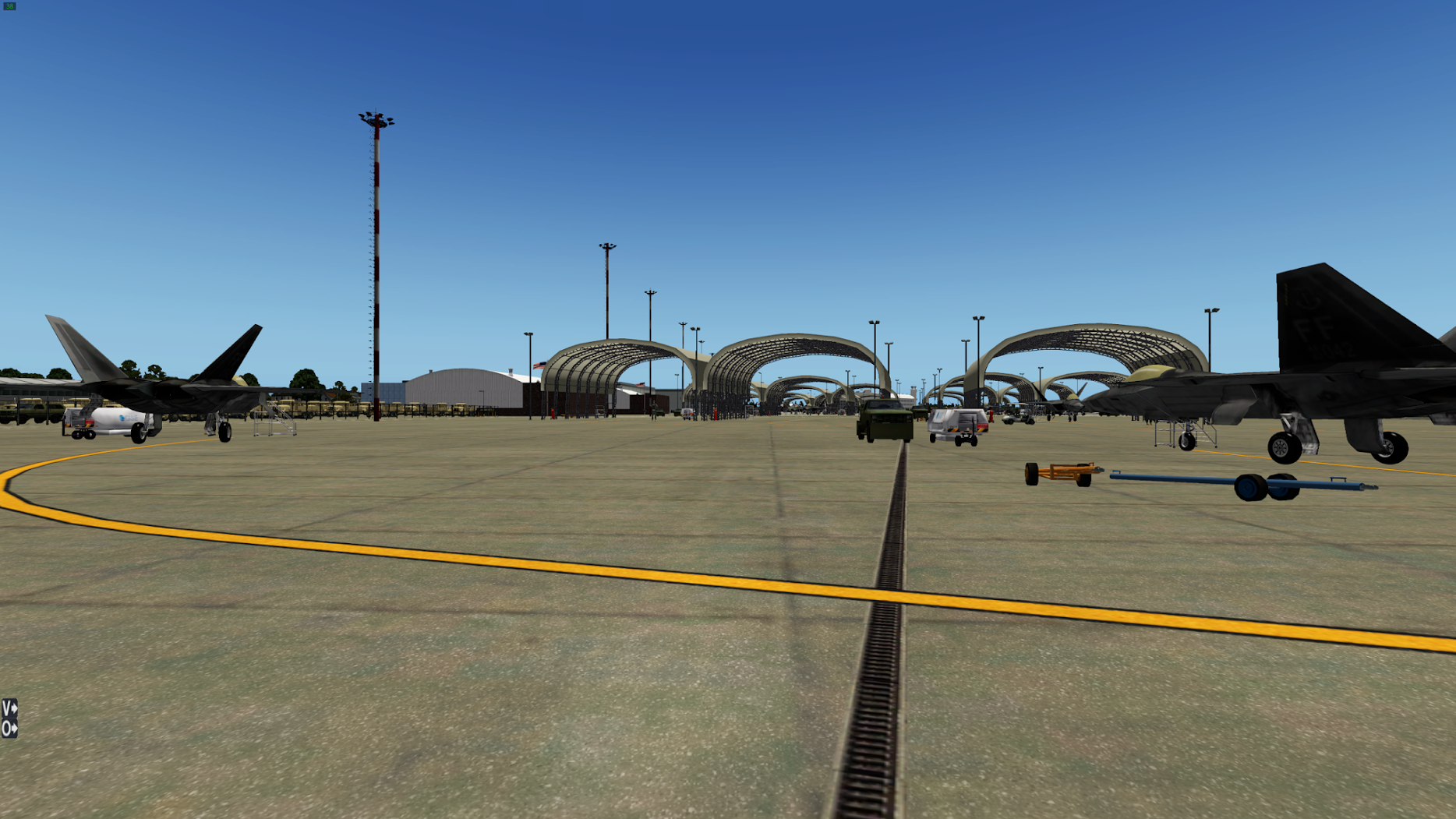
Aerosoft is pleased to offer you on behalf of Freddy De Pues from NAPS, EGLIN AFB / NorthWest Florida Beaches Airport (KVPS). A comprehensive review can be found at ASN.
The NAPS team consist of:
- Freddy De Pues (frede), USA, apt.dat, dsf, traffic, orthos.
- Hans H Gindra (Wheelie), Germany, customized buildings.
- Marc Leydecker, Library.
- Cami De Bellis, Library.
- Brian Godwin, ATC.
- Fabrice Kauffmann, static aircraft.
The airport comes with the following features:
- Customized buildings + OpenScenery
- USGS orthoimagery with gritting textures, polygons follow airport boundaries
- Optimized polys and objects for better FPS.
- Airport integrated in existing scenery & road network, detailed roadways, taxiways, centerlines, pavement signage, signage, equipment, sim's integration, landscaping, lights, etc.
- Autogate
- ATC traffic
- Ground Traffic
Sections included:
- NorthWest Florida Regional Airport, civil facility
- Eglin AFB, West
- Eglin AFB, East
- Helos Training Area (fictive)
- Hot Cargo Area
- Fuel Areas
- Armament Museum
Recommendations when it comes to hardware:
- For high end computers.
What else?
This scenery uses RUscenery, CDB library and will only work in XP 10. Make sure you only have this instance of KVPS running at this time.
If something goes wrong, read the log.text file in your X-Plane 10 folder and try to find anything pertaining to KVPS. You might find something like : KVPS could not find X in Y library, get the recommended library, that's it. If you have the library and something is still missing, do some homework. Ignore AGtrees error reports.
Background information Northwest Florida Regional Airport:
(IATA: VPS, ICAO: KVPS, FAA LID: VPS) is an airport within Eglin Air Force Base, near Valparaiso and Fort Walton Beach in Okaloosa County, Florida. No private aircraft are allowed, so Destin-Fort Walton Beach Airport is used for non-commercial operations. The airport was called Okaloosa Regional Airport until September 2008.
Northwest Florida Regional Airport is served by the regional airline affiliates of American Airlines, Delta Air Lines, United Airlines and US Airways which fly nonstop regional jets to hubs in the southern and eastern United States. Delta Air Lines mainline jets also fly to its hub in Atlanta. In 2008 the FAA recorded over 373,808 enplanements at the airport.
Northwest Florida Regional Airport and Eglin AFB share two runways: 12/30 is 12,005 x 300 ft (3,659 x 91 m) asphalt/concrete and 1/19 is 10,012 x 300 ft (3,052 x 91 m) asphalt. In the year ending March 31, 2006 the airport had 126,060 aircraft operations, average 345 per day: 71% military, 19% airline, 8% general aviation and 2% air taxi.
The airport has a 110,000 ft² passenger terminal with three second-level gates with passenger jet ways and three ground-level commuter gates with regional jet boarding bridges
The terminal is a two-level, 107,000 square foot facility opened in November 2004. The old terminal building was demolished soon after. The terminal has areas for ticketing and baggage claim and upper and lower courses with gates. The first level has Gates A1, A2, and A3 and waiting areas and concessions. The second-level concourse has Gates B1, B2, and B3 and a restaurant and concession areas. The terminal was designed to allow future expansion. The Northwest Florida Regional Airport Master Plan Update says a project to extend the concourse 120 feet and add three gates is under consideration (2010).
Access to the terminal is off of State Road 85. Parking facilities are to the left, the terminal or loop is straight ahead and rental car return is to the right. The airport loop road has two pass-through lanes on the left and three arrival-departure lanes in front of the terminal. The loop road is a two-lane asphalt roadway about ¾ mile long. Short-term and long-term parking facilities are available. The parking facilities were improved in the early 2000s as part of the new terminal expansion. These were designed with the Transportation Security Administration's "300-foot rule" in mind, and satisfy the 300-foot distance between parked vehicles and the terminal building.
Okaloosa County owns and operates the airport terminal, which is on 131 acres of Eglin AFB property that is lease from the U.S. Department of the Air Force. The property is leased until 2031 and limits aircraft operations at 80 per day. It is unique in that the county staffs the airport, yet it leases the property from the USAF. Okaloosa County Commission serves as a policy board and hires the airport staff.
Eglin Air Force Base (AFB) (IATA: VPS, ICAO: KVPS, FAA LID: VPS) is a United States Air Force base located approximately 3 miles (5 kilometers) southwest of Valparaiso, Florida in Okaloosa County.
The host unit at Eglin is the 96th Test Wing (formerly the 96th Air Base Wing).[citation needed] The 96 TW is the test and evaluation center for Air Force air-delivered weapons, navigation and guidance systems, Command and Control systems, and Air Force Special Operations Command systems.
Eglin AFB was established in 1935 as the Valparaiso Bombing and Gunnery Base. It is named in honor of Lieutenant Colonel Frederick I. Eglin (1891–1937), who was killed in a crash of his Northrop A-17 pursuit aircraft on a flight from Langley to Maxwell Field, Alabama.
Eglin is an Air Force Materiel Command (AFMC) base serving as the focal point for all Air Force armaments. Eglin is responsible for the development, acquisition, testing, deployment and sustainment of all air-delivered non-nuclear weapons. The base plans, directs and conducts test and evaluation of U.S. and allied air armament, navigation and guidance systems, and command and control systems. Severe weather testing of aircraft and other equipment is carried out here at the McKinley Climatic Laboratory.
The residential portion of the base is a census-designated place; its population was 8,082 at the 2000 census. Eglin Air Force Base has 2,359 military family housing units. Unmarried junior enlisted members generally live in one of Eglin's seven dormitories located near the dining hall, chapel, base gym, Enlisted Club and bus lines on base. Each individual unit generally handles dormitory assignments. Bachelor Officer Quarters are not available. Several units and one dormitory are currently being renovated in 2011. The base covers 463,128 acres (1,874.2 km²). (Courtesy of Wikipedia)
About the modelled airport EGLIN AFB:
This airport is made for at least very high resolution, gazillions of objects, roads, and forests. This is one of the most detailed airports in the history of XP10, you will see your mother at the kiss-and-go.
Acknowledgements:
- Autogate, Marginal
- Marc Leydecker's Library
- Flags of the World, Real Flag II, Mr3D
- OpenScenery, Ground Traffic, Marginal
- Follow Me Truck, Cami De Bellis
- Mow My X-Plane, by Simon W
- USAF vehicles, David Austin
- Static Mil Aircraft, ThePrivateer
- Concrete Barrier (Military Fortifications), Michael Hoge
- Palm Trees, Dieter Rozenkrans (Mallorca 8.0)
- F-35B ai, Fabrice Kaufman
- Helipad Dolly, by AH-1ZVIPER
- UH-60, hypersonic test pilot
- People, Altair43
- RUscenery, X-Air.ru
- WED 1.2, Ben Supnik, Christiano Maggi
- XPL TaxiSign Generator & Viewer, X-Design CSD
- 322 Downloads
-
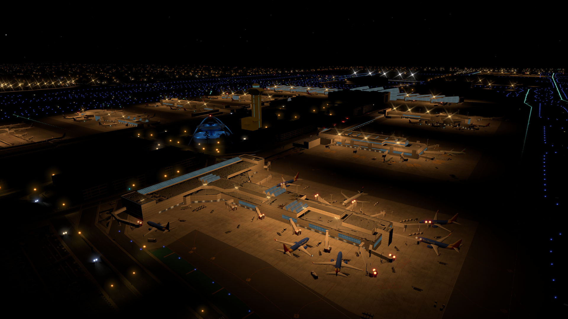
Aerosoft is pleased to offer you, in consult with and his approval of Org user MisterX6, his very well modeled Los Angeles international airport (KLAX).
KLAX Airport features:
- Photoreal scenery for the area surrounding the airport
- Detailed rendition of Los Angeles International Airport (KLAX)- Animated 3D people
- Animated airport vehicles
- Accurate airport layout
- Custom models for terminals and hangars
- Custom high resolution taxiway and runway textures
- Moving jetways and marshallers
- X-Plane 10 HDR night lighting
- Custom static aircraft with updated liveries
Requirements:
- X-Plane 10.30 (might work on older X-Plane 10 versions, not tested. X-Plane 9 not supported.)
- (Optional) Java 8 to run the configuration tool
- (Optional) AutoGate by marginal for the moving jetways
- (Optional) Alpilotx HD Mesh V3
Installation:
Move the two folders to “X-Plane 10/Custom Scenery/" and you’re done! No third party libraries required!
Configuration:
I’ve included a small program that allows you to tweak a few options, to increase performance or to remove static aircraft for online flying. You need at least Java 8 to run it. It has only been tested with Windows. You can start it by double clicking the "Configurator.jar" file. Please note that you should not modify any file or folder names for this utility to run properly. If the program doesn’t work for some reason, you can also manually copy the files from the “Configurator” subfolder to turn off runway textures and/or static aircraft.
Credits and programs used:
- AutoGate and GroundTraffic by marginal
[*]- GetGT from http://www.opalsky.com.au/
[*]- WED 1.31 and X-Plane 10 by Laminar Research
[*]- Blender 2.71 by the Blender Foundation
[*]- Ortho imagery by the United States Geological Survey (USGS)
Donations:
If you like my work, you can support me by making a donation. Donating is 100% optional, but greatly appreciated! And therefore, here's the donation link
Licenses:
USGS-authored or produced data and information are considered to be in the U.S. public domain.
Credit: U.S. Geological Survey
Department of the Interior/USGS
U.S. Geological Survey (http://www.usgs.gov/laws/info_policies.html)
One or more textures in this airport have been created with images from CGTextures.com. These images may not be redistributed by default. Please visit http://www.cgtextures.com for more information.
You may not redistribute this scenery package!
Enjoy!
- 796 Downloads