


Bulau
-
Posts
147 -
Joined
-
Last visited
Content Type
Profiles
Forums
Downloads
Posts posted by Bulau
-
-
The elevations in the .PLN *are* correct. It is only the [GPS_Engine] section of the .FLT that are using the cruising altitude.
I'm pretty certain the problem with the IGC is that we did not pass through the start sector before heading out to first WP. Best thing would be to edit this task, change the CANAL waypoint to something more appropriate, and fly it again.
-
Hand editing the NextWP=0 seems to work for the start issue. Not sure how that will affect the IGC yet. Your other suggestions for start arrangements are also worth trying. We do airstarts in Condor often, but I always like going through the takeoff and tow. It just makes it seem more "real".
Also, hand editing the WpInfo elevations under [GPS_Engine] makes the arrival height display correctly.
Yes, CANAL was an unfortunate choice. I thought it was the Murray Canal, which would be a good visual landmark. Although it is located at the canal, it is as you said, actually an airway intersection. I have Plan-G installed now, so will try making some tasks with that and see how it goes.
-
OK, I did not change anything in that box, but every waypoint I add is using a default "Cruising altitude" of 1368 meters. I don't know where this comes from, but FSX is showing it in a box below the flight plan map. I *can* change it, but just left it. So if I Edit the waypoint, that number show up in the Altitude box. I don't see anything for finding the ground elevation at the waypoints. If I open the .PLN, I can see the elevations there as part of the <WorldPosition> tag. All the numbers there look right, albeit they are in feet, i.e. Belleville (CNU4) is 320' ASL:
<?xml version="1.0" encoding="UTF-8"?>


<SimBase.Document Type="AceXML" version="1,0">

    <Descr>AceXML Document</Descr>

    <FlightPlan.FlightPlan>

        <Title>CNU4 to CNU4</Title>

        <FPType>VFR</FPType>

        <CruisingAlt>4491</CruisingAlt>

        <DepartureID>CNU4</DepartureID>

        <DepartureLLA>N44° 11' 37.87",W77° 18' 13.78",+000320.00</DepartureLLA>

        <DestinationID>CNU4</DestinationID>

        <DestinationLLA>N44° 11' 37.87",W77° 18' 13.78",+000320.00</DestinationLLA>

        <Descr>CNU4, CNU4</Descr>

        <DeparturePosition>26</DeparturePosition>

        <DepartureName>Belleville</DepartureName>

        <DestinationName>Trenton</DestinationName>

        <AppVersion>

            <AppVersionMajor>10</AppVersionMajor>

            <AppVersionBuild>61637</AppVersionBuild>

        </AppVersion>

        <ATCWaypoint id="CNU4">

            <ATCWaypointType>Airport</ATCWaypointType>

            <WorldPosition>N44° 11' 37.87",W77° 18' 13.78",+000320.00</WorldPosition>

            <ICAO>

                <ICAOIdent>CNU4</ICAOIdent>

            </ICAO>

        </ATCWaypoint>

        <ATCWaypoint id="CPF8">

            <ATCWaypointType>Airport</ATCWaypointType>

            <WorldPosition>N44° 24' 12.00",W77° 45' 34.00",+000630.00</WorldPosition>

            <ICAO>

                <ICAOIdent>CPF8</ICAOIdent>

            </ICAO>

        </ATCWaypoint>

        <ATCWaypoint id="CANAL">

            <ATCWaypointType>Intersection</ATCWaypointType>

            <WorldPosition>N44° 3' 38.23",W77° 37' 48.94",+000000.00</WorldPosition>

            <ICAO>

                <ICAORegion>CY</ICAORegion>

                <ICAOIdent>CANAL</ICAOIdent>

                <ICAOAirport>CYTR</ICAOAirport>

            </ICAO>

        </ATCWaypoint>

        <ATCWaypoint id="CNU4">

            <ATCWaypointType>Airport</ATCWaypointType>

            <WorldPosition>N44° 11' 37.87",W77° 18' 13.78",+000320.00</WorldPosition>

            <ICAO>

                <ICAOIdent>CNU4</ICAOIdent>

            </ICAO>

        </ATCWaypoint>

    </FlightPlan.FlightPlan>

</SimBase.Document>
However, in the .FLT, under [GPS_Engine] I find this:WpInfo0=41, 0, 97, 0, 0, 0.0, 0.0, 0.0 WpInfo1=62, 0, 1368, 0, 0, 0.0, 0.0, 0.0 WpInfo2=63, 0, 1368, 0, 0, 0.0, 0.0, 0.0 WpInfo3=63, 0, 97, 0, 0, 0.0, 0.0, 0.0
There is correct field elevation for WP 0 and 3 (Belleville, 97m) but the other two are using the 1368m "Cruising Altitute" I mentioned above. If that is what the GPS is using for arrival height calculations, the you are correct about why it is not what I expect to see, until I round the last WP and start final glide. "Dodgy flight plan" was the technical term you used.
As far as not starting the task in the IGC, I have an idea why that happens, but don't know how to fix it. The .FPL above also has an entry:
NextWP=1
As soon as I spawn in at CNU4 (on the runway) the GPS is pointing to CPF8, so we did not make a proper start. I have many more questions about tailoring these flight plans to soaring tasks, but I'll open another thread for that later.
Thanks for taking the time to troubleshoot this.
-
FSX Multiplayer synchronises time and weather but nothing else AFAIK (assuming you're using FSX IP multiplayer) so each pilot loads their own task
OK, that seems to explain it. We used GameSpy interface, I hosted, and chose the Flight Plan, then waitied for my friend to join. I don't know what it looked like from his end.
Re arrival height, the indication is ***AGL*** at the next turnpoint, in either meters or feet depending on your FSX setting. Perhaps your TP1 was higher than the start airfield? That doesn't explain your 'approaching first TP' comment - any chance the GPS had already swtiched to the second TP?It hadn't switched, I had read about that, so was watching it closely. I wonder if it is the closed, triangular tasks I have made, where takeoff and finish are the same location, which are tripping up the GPS? I notice when I load the resulting IGC into SeeYou, it shows two comments:
"Task Declaration is NOT VALID!"
and
"All reached turnpoints rounded OK, task not finished."
I'll give it a try with a task that has different start and finish locations. Plus, I have a number of questions about constructing soaring tasks using either the FSX Flight Planner, or Plan-G, and if I can't answer them by messing around myself, I'll make a post here.
-
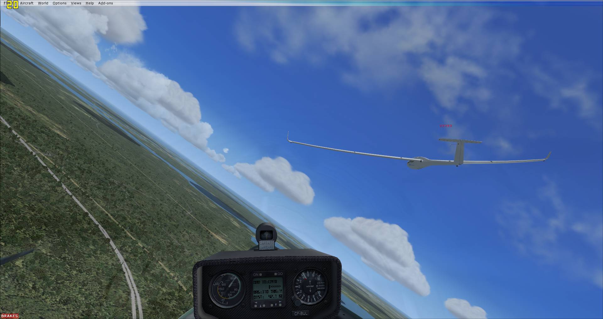
The Cambridge is showing arrival height **AGL** at the next waypoint. The only instrument that calculates arrival height all the way around the task is the SDI C4 in the Aerosoft Discus (I should know, I wrote the code for both...)
I'll fly with it some more and see. On the short 112km task we flew yesterday, the only time the indicated arrival height made any sense to me was on final glide. At the start, it was showing -2300 meters, and approaching first TP, when close enough to see I would arrive with plenty of height, it was still showing -500 meters, and that was with MC still set at 0.0
Only on last leg, after climbing in last thermal, did the number rise into the + range. By then I had bumped the MC up to 2.0
-
There's no Speed-to-Fly indication in any glider except the Aerosoft Discus
I've just downloaded your b21_vario_netto, and the screenshot, and bitmaps for it, seem to be showing a "push-pull" indication, which is what I mean by speed-to-fly.
http://carrier.csi.c...fsx/simobjects/
But I just tried out that gauge, and it seems the push-pull arrows are just static bitmaps on the face, not actually functioning.
Did he have the .PLN file and the .FLT the same as yours?Hmmm, no he didn't. In my ignorance of FSX multiplayer, I had assumed that the hosting process would transmit the flight plan I selected to him.
So that's not what happens, then?
-
Just some question/clarification on the Cambridge instrument and GPS:
If there is some more detailed documentation or forum post, just point me to it.
As far as I could tell, the arrival height it displays seemed to be the finish, rather than next TP. Is that the way it works?
Although I can change the MC setting, and see corresponding change in arrival height, I could not see anthing that was commanding Speed-to-fly. Should I see that anywhere with this particulare instrument? Unable to find such an indicator, I resorted to watching for changes in arrival height, and speeding up or slowing down accordingly.
Also, in my recent multiplayer flight, my friend did not see the waypoint data from the save flight I was hosting on his GPS. Only thing showing on his LCD was "NO ACTIVE WP". How is it supposed to work?
[EDIT] Hold on....I still have the two b21_vario_ folders in my ...Airplanes\DG-808S_SOAR\panel.virtualsoaring\ folder! I guess those should have been put into the GAUGES folder, right! Doh!!!
-
+1
Great add-on, indeed!
-
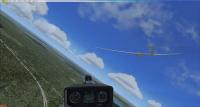
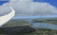
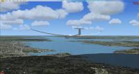
Encountered a few bug and glitches, but overall a successful first attempt. I first tried hosting using the Direct IP method, but my friend could not connect, so we resorted to the GameSpy interface, and that worked. We flew a little 112km triangle out of Belleville, Ontario, North to Campbellford, South to the Murray Canal near CFB Trenton then back to Belleville. Used the SOAR DG-808S with CumulusX!
Both of us had the trim glitch with the sailplane, which I reported in the DG-808 thread, so we both commented out the TrimWizard gauge in the panel.cfg and all was fine.
Another glitch was that his GPS did not pick up the waypoint from the flight plan I was hosting. Also, his towplane did not takeoff, but just sat there on the runway. Second try, he air spawned, and the towplane sat there the entire time we flew.
-
... it looks for the "Apply Brake" event which is on the joystick trigger for most....
Hah! That's it I'm sure!
Without even testing, I know that I'm always clicking my joystick trigger inadvertently, and having trim on rotary just conrtibuted to the issue.
Since the rotary trim works perfectly for me, I think I will just disable the TrimWizard in the aircraft panel, and put my brake assignment back.
Thanks!
-
The DG808S hasn't got any code in it that manipulates the trim value, so the issue is very unlikely to be related to the aircraft. The trim changing with the operation of the control is handled by standard FSX.
...turn off trimwizard and see if it fixes it...
I was thinking I may have inadvertently hit the apply brakes key, thereby activating the TrimWizard.
What I did after, was delete all the controller assignments for brakes. Probably the more scientific approach would be to try deliberately activating the Trim Wizard, and see if I can recreate the issue.
-
...Wolfgang's Duo Discus has an *infinite* glide ratio if you fly slowly enough...
OK, good to know. So far, I have installed the 2-33A and Blanik from Wolfgang, largely because I trained on those out of Belleville, Ontario. On the weekend, I made and flew a 110km task from Belleville, using the Blanik, FSX Flight Planner, CumulusX! It *seemed* realistic enough...i.e. at 140 km/hr, the ground was getting near alarmingly fast! I've tried the SOAR DG808S on another task I made in Austria/Germany, but have encountered some trim issues with it, which I posted elsewhere, maybe due to the TrimWizard...not sure yet.
...In FSX, the cockpit panel GPS instrument will automatically direct you around the FSX flightplan....The CAISET instruments include a GPS which does not read the FS flight plan, but has to be programmed separately. Development on these programs stopped at least five years ago. You would be nuts to *start* with this software in 2010. You might be able to get it to work, but you wouldn't be able to give the task to anyone else...
...My advice is load the UKVGA ASW28:
create a flight plan, and you'll see it displayed on the moving map and the GPS-NAV. Or try a similar thing with the SOAR DG808S.
...Actually creating tasks is very easy - just use the inbuilt task planner or Plan-G...The CAISET/FSwever2 stuff is obsolete and even if you get a task loaded for yourself, you'll never be able to share it....
I discovered the GPS direction feature in the task mentioned above in the SOAR DG-808S. But have not figured out arrival height and MC settings. The CAISet seems to cover all that, albeit in text form (no moving map). I thought it would be possible to simply distribute the GPS-NAV.dat file along with the other FSX files for the flight plan, then everyone would have the CAISet GPS TP info for the task.
I have the ASW28, but not tried it yet. It is the Standard Class sailplane I usually fly in Condor, and the moving map display in your pic is like what the Condor PDA would display. It would be a good platform for any comparisons.
Also downloaded Plan-G, so will give that a try and see if it makes the process any easier than the FSX Flight Planner. If it lets me make triangular tasks without the Notepad hacking, it will be a step ahead!
...'GameSpy' lobby service added as an afterthought just before FSX went to release, but it was absolutely hopeless and I advise you to avoid it. Here's the direct IP connect info....I'll be interested to see how far you get with FSX multiplayer - the direct IP approach is the one I'd recommend.
OK, I was planning to try the Gamespy route, and already set up an accout. We are familiar with the direct IP process, though, which can be done in Condor, and also the other sim we use, IL-2 Sturmovik:1946. Those MS instructions are pretty much guaranteed to fail for anyone behind a router, which is pretty common. I've forwarded ports UDP 23456 and 6073 on my router, not sure if those are all I will need.
Thanks for your continued attention, Ian. I will certainly keep you updated about our progress. What Time Zone are you in, by the way? We are Eastern Standard Time (southern Ontario, Canada) Would be kind of cool to have you fly with us some time.
-
I've encountered, on two occasions now, with this aircraft, some erratic elevator trim behaviour. Maybe it's too little data to point a finger, but here goes:
This happened first time I tried the aircraft, immediately on takeoff, and the second time it happened 15 minutes into another flight, the forward stick pressure required to maintain speed suddenly goes way up, and I'm holding the stick almost full forward. My elevator trim, which is on a rotary, shows wild twitching of the cockpit trim lever when I rotate the knob, but always ends up stuck at the full rearward position when I stop rotating it. In Windows Control Panel, the rotary shows no sign of erratic movement, but is smooth as silk.
Anyone else encounter this issue?
Could it be caused by the "Trim Wizard"?
-
* Missions are slick, but a lot of work to produce, used to be essential for soaring FSX, and now are not really needed...
* 'Task 1' from Peter was pretty much the first soaring task *not* using the 'mission' format, so you don't get some of the candy but it *is* possible to create completely workable soaring tasks with FSX add-ons without using the missions system:
The CAISET is functionally ok but dates from FS98 and is problematic to install for many users of FSX, compared to the simple drag and drop of a FSX glider. The glide performance of many (most) FSX add-on gliders is very inaccurate,
Plan-G to create the soaring task (a .PLN file),
Cambridge Aero Explorer Plus will enable you to view and analyze logfiles of those that attempt the task
If you've come from Condor, the key difference is that FSX soaring is not typically real-time multiplayer.
Perhaps you can write up your comparison of Condor and FSX when you'e tried a few FSX cross-country tasks.
Wow, B21, thanks a lot for that detailed info! That probably saved me a lot of forum surfing! I try to read as much as I can before wading in with a lot of questions that have been answered upteen times before.
I have downloaded a lot of those missions, and not actually flown them, but just spawned in to see what they are like. I immediately realized I had no clue about how the CAISet/GPS/Flight Computer worked. I have experimentd a little with laying out and saving a couple of flight plan as you have described, but it is the whole process (ala the Condor PDA) of using the Glide Computer to start, and follow the task that eludes me at the moment. I found the CAISet manual, and was planning to read through that to get a handle on it.
I also found the old FSZViewer2, and played around with it to load .dat files from the Worldwide TP Exchange, select a task, and save them to a file. I thought that would be a possible route to generate a task for the GPS-NAV, but it sounds like the Plan-G you mention is the current tool to use.
I host a dedicated Condor server, and fly weekly with my brother and a few friends, so my plan is for us to actually do the multiplayer thing with FSX, initially to duplicate tasks we have flown in Condor.
I'm a little surprised about the glider performance comment...does that apply to Wolfgang Piper's gliders? (many of which we have downloaded already)
I did read another post of yours here, where you mentioned the robust multiplayer community that Condor has, as compared to FSX.
At this early stage, I would say that a couple of the more obvious reasons for that (as I'm sure you know) are:
1. Condor was designed from the get-go to be a multiplayer, competiton soaring simulator, and to that end...
2. It comes with a ready-to-use Dedicated Server, that is simple to set up, and will run on pretty much any old Windows PC
3. Any dedicated server running, or anybody hosting with their game, shows up on a community serverlist webpage, and joining any of those hosted tasks is as simple as clicking on it.
4. Creating tasks in the Condor Flight Planner is dead simple, especially in comparison to the way it seems to be done in FSX
Not to come off as a Condor Fanboy, I'm sure I will love FSX as much as Condor, but those are some of the obvious reasons why Condor has such a thriving multiplayer commmunity. Tools like CumulusX! and the methodology you guys have developed for creating and sharing soaring tasks are a needed step in the right direction for FSX.
-
Anyhow, if it runs you should stick with your current configuration.
Will do. If it ain't broke, don't fix it!
FWIW, I poked around on all 3 Gold disks. I could not find anywhere a separate folder or install of SP1.
Although there is an SP1.cab file, it does not contain the SimConnect.dll
There is another Products.cab file which contains several SimConnect.dll..etc files.
There is, of course, the SimConnect.dll for SP2 and its associated Manifest file.
-
Please uninstall AP (only), download SP2, install it, uninstall it again and reinstall AP.
OK, thanks...downloading now.
Just to clarify, I should do this even though CumulusX seems to be running fine?
-
SP2 is essential for CumulusX! and, by incidence, the important Sp2-SimConnect library remains on the system even after uninstall of SP2 unless you uninstall FSX completely. So now you have all possible Simconnect versions onboard, RTM, SP1, SP2, and ACC.
I read the warning in CumulusX manual about possible crash under AP, so was fully expecting it to happen, since I have FSX Gold installed with AP.
But, it did not crash and runs fine. I noticed, when installing FSUIPC4, that it did a check for installed SimConnect(s), and it found three:
Checking compatibility with installed SimConnect:
Found SimConnect build 60905 (Original)
Found SimConnect build 61242 (SP1 May07)
Found SimConnect build 61259 (Acc/SP2 Oct07)
So, unless MS has changed the AP, it seems not a foregone conclusion that the required SimConnect library is missing from the AP version of SP2.
I also have only DotNET 3.5 installed, none other.
-
Thanks, Peter! I actually figured it out after reading the tutorial about getting the GPS waypoints for a mission (and making triangular flight plan by editing in Notepad.
http://carrier.csi.cam.ac.uk/forsterlewis/soaring/sim/fsx/dev/gps/
Now I understand these are saved flight plans, whereas I had them confused with missions at first. I just bought and installed FSX for first time a few days ago, so I had no idea about this folder where the saved flight plans go, but I found it now. My goal is to create and host some soaring tasks for a few friends I fly with in Condor. We want to see what soaring is like in FSX.
I have FSX Gold installed, plus a few of Wolfgang's gliders, FSUIPC4, CAISet, and CumulusX. Eveything is working, but still trying to get a feel for it all, and reading as much as I can find.
-
I know this is old thread, but how are these task (Task1 and Task2) installed? The ReadMe refers to "...the directory, that is used to hold Flightsimulator files", but it's not clear to me exactly what that might mean. I've tried putting them into a Mission folder, but no joy.
OK, I see the new version of Task 1 just above, in Mission form, thanks. What about the files in Task2?
What and where is the most current happenings for soaring missions and competitions? Everything here seems to be several years old.


Soar Dg808s Version 3 Available For Free Download
in General Discussion
Posted
Yes, it is the latter. We didn't pass through the default start waypoint, which is like a little 500m circle, and we didn't do that because the GPS was navigating us to the next waypoint. Yes, I can get SeeYou to show the task as started and finished by changing flight properties so the the start line is longer.
I just made another test task, this time created the flight plan in Plan-G, a very short triangle, and saved it to FSX .PLN file. Then opened that in Flight Planner, set weather, aircraft, time, etc. and saved as a FreeFlight. Hand edited the .FLT as discussed previously, i.e. GPS elevations, NextWP=0. Flew it, and absolutely everything worked as expected. During takeoff and tow, GPS pointed to CNU4 (the spawn airport, and the start waypoint). After release, thermalled a bit, then blew across the runway on a heading for the first leg. Crossing the runway, GPS switched to first waypoint, etc. etc. Arrival heights all as they should be, and crossing the runway back at CNU4 for the finish, the GPS switched to "No Active AP".
Saved IGC looks correct in SeeYou. I shows the entire task flown and completed, but still says Declaration is NOT VALID! In RL soaring with PDA, is there not a requirement to "Declare" the task before starting? I don't know how to do that in SeeYou.
In any case, I'm beginning to understand that SeeYou can be tailored to match the way the task was intended to be constructed, start sector or line, lenght, turnpoint sector or cylinder, radius, etc. Whereas the cockpit GPS is very primitive, and assumes each waypoint is a small cylinder.
BUL_TestTask1_2010-12-24_1714.zip