

Bulau
-
Posts
147 -
Joined
-
Last visited
Content Type
Profiles
Forums
Downloads
Posts posted by Bulau
-
-
Re: XCSoar:
YES - that's exactly what I was dreaming about.
These are even better than the Cambridge solution - they are free.
Now all I have to do is to connect my brothers iPaq to the GPS-NAV or a Cambridge 302.
I used XCSoar with Condor, but not on a PDA, rather the PC version, running on a second monitor. I was trying it because Condor currently does not handle AAT tasks.
This reminds me of another class of problems with FSX soaring tasks, and those are concerned with creating and sharing the task in the first place, and then to score it afterwards. I learned from Ian that FSX Missions were tried at first, then just simply using the saved Flight Plan (four files which can be distributed) scoring by submitted IGC. I've tried the latter, using Plan-G for the initial task layout, and it works fine...easy enough to distribute the task.
The CAISet offers another method, working from a .dat file, setting a task in the Viewer, send it to CAISet, and distribute the resulting GPS-NAV.dat file. This method also works fine, and I tried it just last night with my friend in a multiplayer session. Some added difficulty presented itself because we set a task using our own turnpoints, which are not in any .dat file. This was handled with Plan-G, followed by a little cut-and-paste and hand editing into a custom .dat file, loading that into the Viewer, etc. It would be nice if there were a simpler route from Plan-G to a .dat file, e.g. if the Viewer could load either a Plan-G file, or an FSX .PLN and then save that to CAISet, or if Plan-G could load and save .dat files. I don't know...just thinking out loud...
Some other aspects of typical soaring tasks which are not currently handled well in FSX, although they can be dealt with at the IGC level in the software that displays them:
1. Start line, or start sector, and its dimensions
2. Maximum start altitude
3. Turn point shape, (FAI sector or cylinder) and dimensions
4. Finish line, sector, or circle and its dimensions
5. Minimum finish altitude.
Here, my inexperience with RW soaring tasks hinders me. All of the above is handled very simply in the Condor Flight Planner, but not AFAIK in FSX, except maybe the maximum start height, which can be set as the elevation of the starting waypoint. Both the FSX and CAISet GPS seem to have a default waypoint, which is a 500m radius cylinder. What does a RW soaring pilot do, using the Cambridge instruments, to account for a 3km long start line, perpendicular to the course line? Modern PDA soaring software handles it, but in FSX all starts are 500m radius cylinder, same for finish.
Sorry to ramble, but this is where I'm at with my very limited experience in FSX soaring tasks. I offer this, not so much as request, but for discussion.
-
...is Bulau your first name or just a nick? First names are so much nicer to use here...
Bulau is screen name. Real name is David Billo
I'm sure I can put multiple tasks in the CAIset (rather easily) but what about the Viewer ?Not sure I understand the question. The Viewer seems to only handle one task at a time. I'm just learning how to use these tools, so was just seeing if that feature would actually work. My thought was to make up a master .dat file for each soaring region I would fly, and have it preloaded with 10 tasks of my choosing (by cut and paste method). You are right, though, that it does not take much time to set a task in the viewer and send to to the CAISet. So, not a priority.
The most urgent to me seems to be the matter of "right" virtual polars - it would be great if we could solve that one.Let me know what you would consider the most important issue(s) right now.
I'm completely new to FSX soaring, so probably not the best person to ask. I come from a couple of years of Condor Soaring Sim, so I'm used to having everything there in terms of soaring software, PDA, moving map, STF, Arrival Height, etc., all automatically adjusted for ballast on board...maybe a tad unrealistic, I don't know.
I'm following with great interest the work of Ian and now, your renewed interest in the CAISet. I would agree that the polar issue is the priority...we need correct virtual polars, and a simple, reliable way to handle them. In fact, I'd be quite happy with what the CAISet already provides if I could count on making, or getting, a correct virtual polar for it. It shows everything I need in clear, easy-to-read format. Beyond that, anything else you or Ian produce is going to be icing on the cake.
Those who have been at the FSX soaring game for many years may have different thoughts.
-
Thanks, Bert, good to know.
-
I learned speeding up in headwind almost 30 years ago, while acquiring my gliding license. Don't know why Reichman didn't had this, but his book is older actually...
It's mentioned in my copy, 4th printing 1988:
In Part I on page 57 (adjusting the ring for wind)
And in Part II, page 97ff. (moving the polar to account for wind)
However, he does point out (as did Ian) that this only applies when you are trying to maximize distance, not speed. (Page 99) If you are trying to maximize speed, then wind can be ignored, "Since the best cruise airspeed will result in the best groundspeed as well".
-
What is the method for storing multiple tasks in the CAISet? (or is this RW feature not implemented?)
I have this in my GPS-NAV.dat (partial)
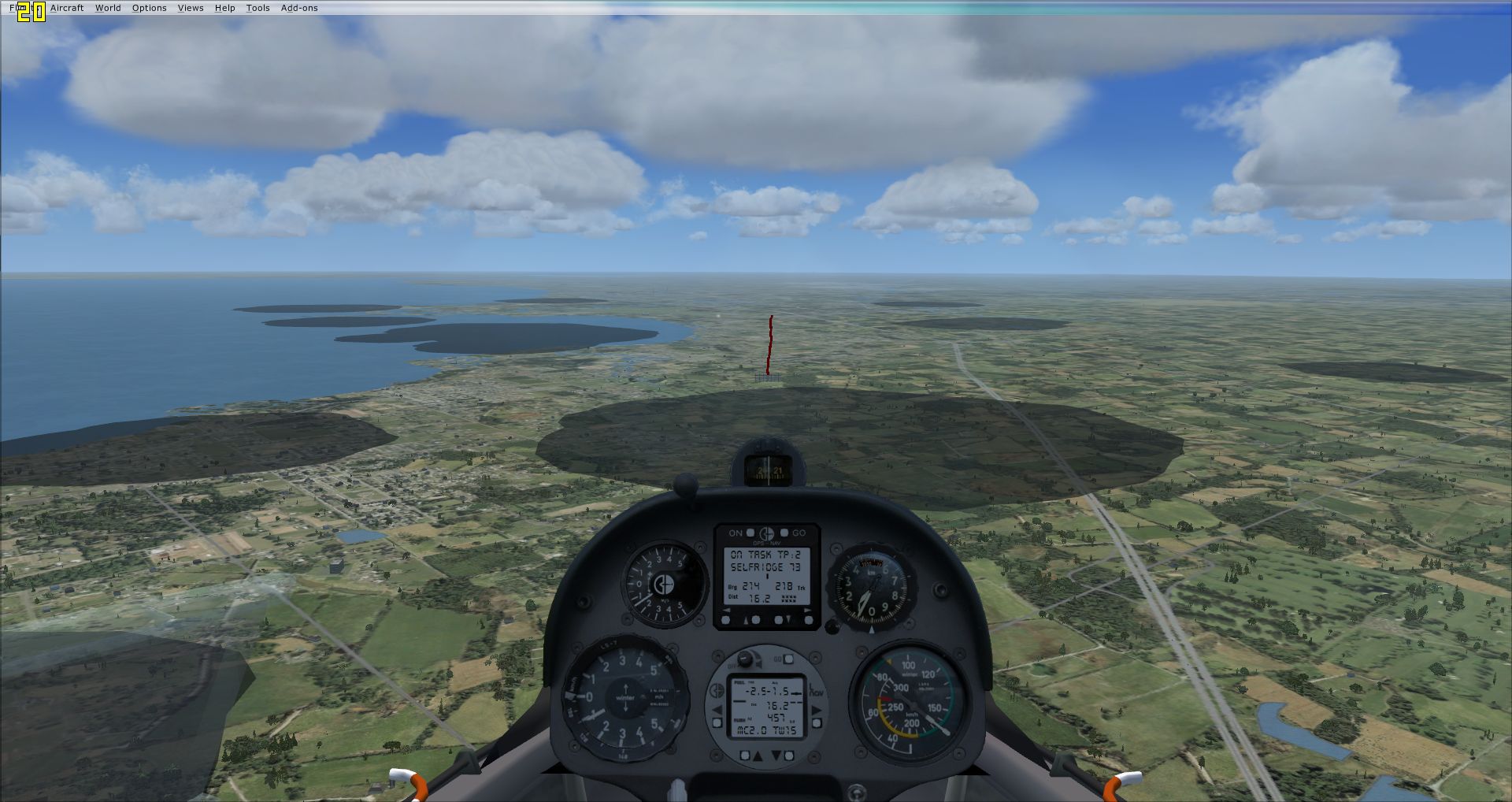
0066,44:11:26N,077:18:54W,320F,TA,Belleville  ,Gravel

0067,44:11:30N,077:19:38W,3937F,S,BlvlSTART  ,

0068,44:19:13N,077:19:46W,410F,T,Scuttlehole ,

0069,44:24:12N,077:45:34W,630F,TA,Campbellford,Turf

0070,44:11:05N,077:06:28W,298F,TA,Tyendinaga,Hard

0071,43:00:17N,082:18:56W,593F,TA,Heritage,Hard

0072,42:54:39N,082:31:43W,649F,TA,St Clair CO ,Hard

0073,42:36:46N,082:49:54W,577F,TA,Selfridge AB,Hard

0074,42:35:26N,082:22:37W,600F,T,WWorld      ,

0075,42:48:20N,082:27:58W,600F,T,HPlant      ,

A0,0067, 123.4,,,,

A1,0068,  14.3,,,,

A2,0069,  35.4,,,,

A3,0070,  57.2,,,,

A4,0066,  16.5,,,,

B0,0071, 149.1,,,,

B1,0072,  20.2,,,,

B2,0073,  41.3,,,,

B3,0074,  37.3,,,,

B4,0075,  25.0,,,,

B5,0071,  25.3,,,,
It allows me to select Task A, no problem, but Tasks B to J show nothing, and selecting Task B just defaults back to Task A after going through the Declare? Start? clicks.
-
That's looking really good, Ian! Looking forward to trying this out!
FYI, that is the way Condor handles STF, toggle the vario to STF mode, then centre the needle on zero. Very intuitive, IMO.
I'm curious now, about how you handle the polar. What polar are you using, and does that mean the gauge is then specific to a particular glider? I.e., you would have a separate gauge for each glider, placed in the aircraft folder, rather than the generic gauges folder?
-
Thanks! And I even own that book!
CAISet still have lots of life in them, IMHO, a tribute to your work.
-
Has anyone ever used, or thought to use, the Jone-Soft Generic Mod Enabler with FSX to handle add-ons and similar files or folders? Essentially, it's not much different than manual drag-and-drop with overwrite, but JSGME makes it easier to manage, and name, what you're dragging and dropping, plus it keeps track of what's been overwritten so you can undo it.
It occurred to me that if might be useful for handling various copies of GPS-NAV.dat and LNAV_polar.dat. I know that the FSZwever Viewer 2 tool handles thise files quite admirably, but suppose you spent some time making some tasks for the CAISet gauges that you want to use again? The JSGME seems a simple way to keep on hand a number of different versions of these files, named descriptively, and activate them with a couple of mouse clicks.
It could also be used to activate and deactivate any number of add-on aircraft, so you can keep your FSX install pared down to the bare minimum of what you normally fly, but add something back in with a few clicks.
-
Question: What happens in multiplayer if I fly an aircraft that the other players don't have installed? Will I be invisible?
-
So Max, that must be why you didn't include the polar function in the updated version of the FSZwever View program.
Hey B21, I never thought to ask this before, and don't understand why I didn't, but does your guages use the same GPS-NAV.dat file?
The version I downloaded has the polar function, at least the function to load the list of polars from LNAV_polarlist.dat, select one, and send it to LNAV_polar.dat. One problem I've noticed is that some polars that ship with a glider are corrupted from the get go, and need to do some hand editing.
Not to speak for B21, but I'm certain his guages are picking up nav data from the .FLT fie, same as the FSX gpsnav does. Plus, I assume, his arrival height instrument is getting polar data directly from FSX for whatever glider you are flying, I don't know. I'm pleased to hear he's working on a speed-to-fly indicator. It would be great to have that and not have to depend on a 'dodgy' polar.
The Speed-to-Fly in Max's CAISet works like a charm, *if* you can be sure to get the correct polar! If I knew the best methodology for getting a polar from an FSX flight test, I would try to do it myself.
-
I ran across another post by SlaminSam, who was having the same sort of FPS drop issue, and appeared to have isolated it to the sounds for the SOAR DG-808S, or rather some conflict between those sounds and Windows. I can't recollect offhand where that thread might be...
Every time this has happened to me, I was flying that glider, but it doesn't always happen, and I've had hour plus long flights without it happening.
-
One odd thing I noticed, when I'm cruising, and fly through lift, the "height above goal" readout will actually go down, whereas I would expect it to go up. I can only think it is because I'm not slowing down for the lift. Eventually, it seems to recalculate and then show the extra height above goal I gained in the lift.
But even if I stop to circle, while circling in lift it will often show a negative number for height above goal.
-
...I am using Kris Feldmann's old CAI-set pop-up panel if the aircraft I fly doesn't have the CAISET installed.
...For multiplayer in FSX, I almost always use FSHostClient and TeamSpeak3.
OK, we are using TS3 also, and run our own TS3 server. We're not using FSHost, however, but have been connecting through the FSX Gamespy interface. I haven't been able to make the DirectIP method work.
I just tried out the CAISet gauges in the LS8-18, and like the way they look and function.
What method or tool are you using to edit your GPS-NAV.dat file?
-
... I never succeeded to get the polar issue right; real polars won't work - you really need the polar from the virtual plane...
I found Kris Feldmann's old FS2002 website, where he has a list of polars for various gliders:
http://www.rotted.com/fs8/polars.html
Kris says there that he created these polars from flight tests, but does not describe his methodology:
I'm constantly improving upon my methods for generating polars. The polars I'm posting may change from week to week if I feel I've made more accurate measurements. I'm finding that the L-Nav really can work very nicely if the polar is just right.I read in the CAISet manual, that the required waypoint format is:
1,46:34.950N,009:50.250E,2312M,S,Albula 1,Passhoehe
however, .dat files I download from the Worldwide Soaring TP Exchange, are in this format:
22,47:32:33N,012:13:25E,882M,T,HntrstnrS 22,Ostspitze
slightly different way of expressing the LAT and LON coordinates. Nonetheless, they seem to work OK. Does the CAISet handle either way, then?
-
Well, Max, if it still works...

Wolfgang last updated the LS18-8 as recently as August of this year, and it still has your gauges. I just had a quick look at the virtual cockpit today, and the CAISet is much clearer and easier to read than the FSX GPSnav.
I have no idea what's involved in making a new one from scratch.
-
LOL! It's all new to me, my friend! Keep an eye out for some more "zombies"!
Seriosly though, I spent most of the day reading about LNAV polars and one of my Google hits was this post.
At least I was on topic, eh?
I have installed the ASW28, but not flown it yet, we've only been using the SOAR DG so far. What appears better about the CAISet (without having actually flown with them yet) is it looks clearer to read than the FSX GPS, *and* it has Speed-to-fly indicator. As you mention, though, the problem is finding, or making, a polar string for the LNAV. FSZwever2 has a function to read a list of saved polars, and send a selected one to the LNAV_polar.dat with click of a button.
What we'll probably end up doing is using CAISet for GPS navigation and LNAV for glide computer, but stick with your Winter TE vario and sim_logger for IGC...I don't know, we'll see. I haven't chosen a glider yet with CAISet...maybe the LS8-18, since it comes with the LNAV polar.
I also spent some time reading about panel.cfg. I'm going to try substituting the CAISet for the GPS and Cambridge in the SOAR DG, since we are confident of the flight model in that airplane. But, just need to find or create a polar string for the LNAV. Getting close!
-
From my reading of the LNAV, the correct polar needs to be in the LNAV_polarlist.dat file to get the most accurate information. The default file has the ASW20 polar. There is also a polarlist file, which contains a few more. I was also able to find a table online which had yet a few more polars for the LNAV, however, it's hard to find the ones to match up with the most current FSX gliders, specifically the DG-808S.
Well, I found Wolfgang Piper's little program, PolarCalc 1.02, and, as well as having LNAV polar text for all his gliders, might also let you generate polars by feeding it the results of a test flight.
-
Is there an LNAV_polar.dat available for this airplane? I'm going to try using the CAISet gauges, and just need a polar for the LNAV gauge.
If not, I've dug around online and found some resources, and maybe can figure out how to make the file.
Ian, is your L/D gauge available for download?
-
After reading this post over again, I need to rethink how I'm doing this. I made the flight plan, but I should have been making a mission instead, just wasn't thinking totally really.
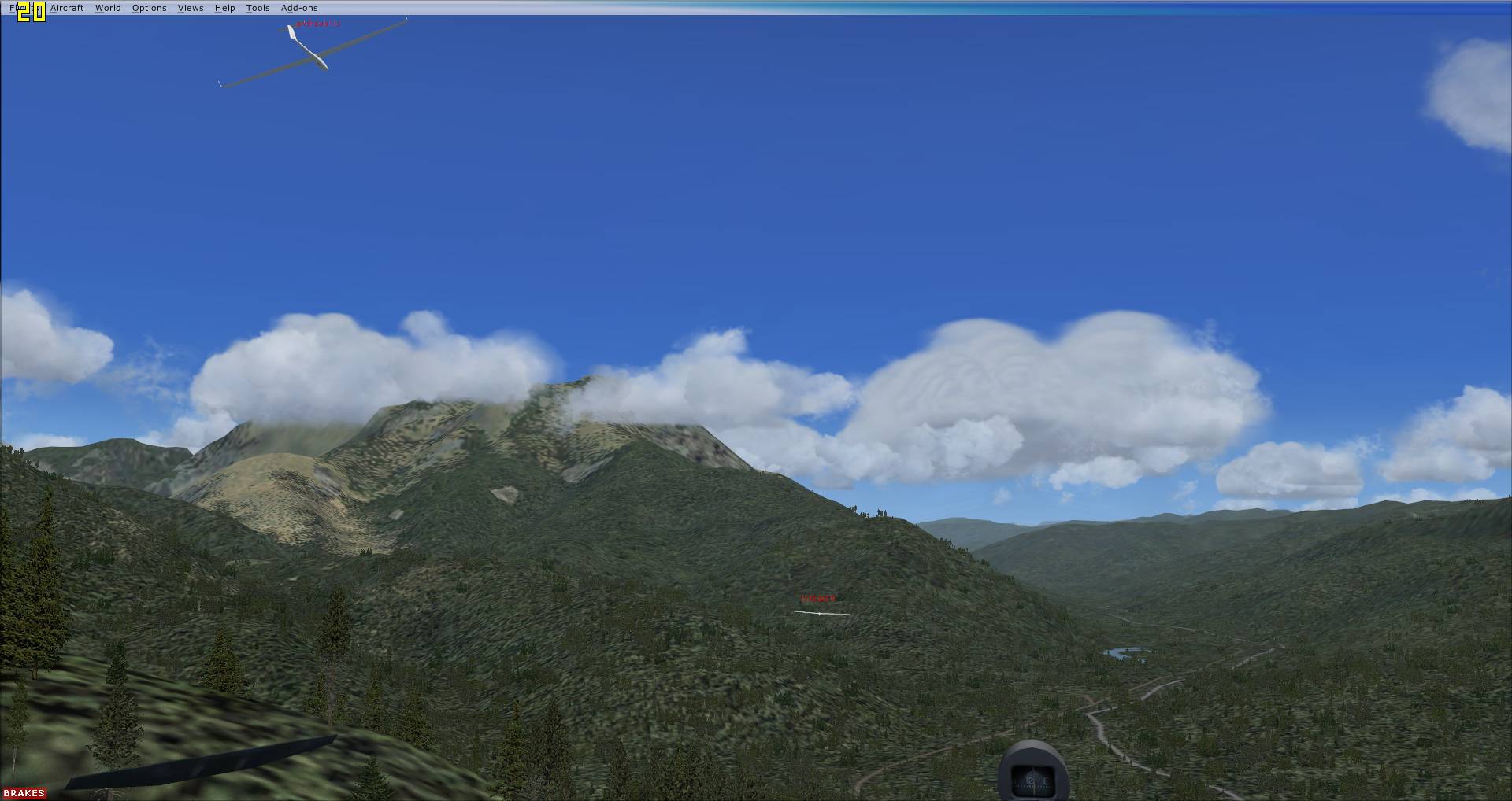
Hi, Scott! I've been experimenting with FSX multiplayer for soaring task, along with my brother and another friend. I've been getting a lot of assistance from B21, and had a couple of multiplayer flights so far. The three of us have just installed FSX, CumulusX!, and a few gliders, but only used the SOAR DG-808S in our multiplayer flights.
Since you appear to be trying to do multiplayer tasks in FSX, it would be great to compare experiences, and possibly hook up sometime for a multiplayer flight. The three of us are in Southern Ontario, Eastern Standard Time Zone, and I note that you are in Rapid City, Moutain Standard Time Zone, which is only 2 hours apart.
I've downloaded your files for this contest, and will have a look at it, and possibly give it a try with my flightmates sometime soon. We've been using the FSX GPS unit in the SOAR DG-808S, along with B21's Cambridge vario with the arrival height display. We have not tried the CAISet gauges, but I've been reading through the manual, and they seem to offer a lot of features that are very useful for soaring tasks, so I expect we will try them out very soon.
Looking forward to hearing from you.
-
Another successful multiplayer task tonight. This time, also had my brother along, so three of us flying a ridge task out of St. Johann, Austria, "High King - Wild Emperor".
And, Ian, yes, by sending my flight plan files to the other participants, they are able to load it when they join, and then had the required GPS info to navigate the task, complete with arrival heights displayed on your cambridge netto vario.

-
Take a peek at this page with a few missions for download...
...start with the SOAR DG808S glider. This has FSX instruments and a carefully calibrated glide performance. Other pilots can change the glider used for the task but at least you've set up a good starting point. The CAISET is functionally ok but dates from FS98 and is problematic to install for many users of FSX, compared to the simple drag and drop of a FSX glider.
I tried the Austrian Soaring Day 2 task...very nice job, Ian! I can see the appeal of the extra frills that the mission format provides, but agree it seems like too much extra work for tasksetters. I was watching the GPS on that, and it gives a slightly early indication of reaching a turnpoint than the mission itself. I turned early at WP1 as a result, and was well on my way back before I realized the compass was still point back at the turnpoint...lost about 5 minutes backtracking.
Having used the SOAR DG-808S, with the FSX GPS and your Netto Cambridge, I've kind of got the feel, now, for working with those instruments. However, reading up on the CAISet instrument, it appears to offer a lot of features which may make if worth the little extra trouble to install and use. For one thing, it has a Speed-to-fly indicator (push-pull). Also, from the manual pictures, it looks clearer to read than the FSX GPS, although I have not yet tried it out to see if that is actually the case in the cockpit.
Regarding sharing a task using the CAISet instruments, it seems as simple as just adding the required GPS-NAV.dat and LNAV_polar.dat files, along with the other .PLN, .FLT, .WX, and .csx files that you would distribute for the flight plan, or am I missing something? From what I've seen of editing panel.cfg files, it seems like not a lot of trouble to substitute one for the other. I'll try a task with both instruments with my brother and friends, and let you know how it works out, or if we hit a snag,
-
Well, thanks to all your help, I feel I'm in a position to start experimenting with some multiplayer tasks with my brother and a couple of friends. I need to figure out why the DirectIP method is not working, perhaps a port I have forgotten to forward.
Despite the obvious problems with FSX multiplayer for soaring races, I and my flightmates have practically zero interest in flying tasks alone offline and just comparing IGC files. Even if the IGC is required to score the task, we would still want to fly the task together, communicating on Teamspeak all the while. I'm certainly not expecting to cover any new ground, but will update the forum on what we're doing.
-
I'm unsure as to why it happens for you. But I'm almost 95-100% sure I have both enabled with no problems. ... I'm running Windows 7 operating system with the program running in "Run as administrator" mode.
Thanks for input, Scott. No. I'm running XP SP3, so don't have to worry about those sort of issues. This may have happened one time *before* I installed the SDK, but it was such a bizarre indicent that I'm not sure. On that occasion, when I spawned in, somehow I was in slew mode (don't ask me how, maybe a typo invoking the towplane Ctrl+Shift+Y), and after whizzing sideways and up and down a bit, with no idea how to make it stop, I ended up at cloud level, and the frame rates down to single figures. At the time, I thought maybe it was proximity to clouds.
The more recent occurences of FPS dropped coincided with using the Traffic Explorer and controlling the towplane. So, not really enough data to point fingers yet.
So, just reading your sig banner...B21 has been bringing me up to speed with soaring tasks, but it seems the multiplayer aspect has been largely abandoned. It sounds like everyone flies the tasks by themselves offline, and then just submit IGC, or fly with everyone else's "ghost". I see you are in SD, which is what...Central Time?
-
I installed the SDK, of course, just to get the Traffic Explorer so I could control the tow plane. Works great, thanks!
Except, I've had on a few occasions since, after a few minutes into the flight, the frame rates start to plummet, eventually bottoming out at 1 FPS. I'm not sure if it's something unrelated, or something to do with Traffic Tools, or other Tools that got added. I read something online about enabling the things added in the dll.exe, and I edited two items there, changing the <Disable></Disabled> tags to False:
  <Launch.Addon>

    <Name>Traffic Toolbox</Name>

    <Disabled>False</Disabled>

    <ManualLoad>False</ManualLoad>

    <Path>..\Microsoft Flight Simulator X SDK\SDK\Environment Kit\Traffic Toolbox SDK\traffictoolbox.dll</Path>

  </Launch.Addon>

  <Launch.Addon>

    <Name>Visual Effects Tool</Name>

    <Disabled>False</Disabled>

    <ManualLoad>False</ManualLoad>

    <Path>..\Microsoft Flight Simulator X SDK\SDK\Environment Kit\Special Effects SDK\visualfxtool.dll</Path>

  </Launch.Addon>
Do I really need both of those items to control tow plane, or can I turn the Special Effects off again?

Soar Dg808s Version 3 Available For Free Download
in General Discussion
Posted
Thanks, Ian! Got it.
Does the above line mean we can sub any font?
Or are we truly stuck with the MS Quartz?