


KuntaKinte
-
Posts
227 -
Joined
-
Last visited
-
Days Won
3
Content Type
Profiles
Forums
Downloads
Posts posted by KuntaKinte
-
-
10 hours ago, Richard Dastardly said:
How's the real jet at slow speed on AP, if anyone's actually got it in that state?
As long as the AP is activated, the real aircraft would never start a descent or climb due to airspeed changes. It would increase/decrease pitch to maintain altitude. At low airspeeds this would go as far as stick shaker onset. The same is true for climb with V/S or PITCH mode.
When the aircraft approaches a high angle of attack, the stall protection computer will:
- warn the crew of an impeding stall through the stick shaker,
- activate the engine auto-ignition system and
- disengage the AP
On 5/3/2022 at 3:48 PM, Secondator said:it's highly unusual to fly an aircraft at such slow speeds in normal operations
Agreed. But overall, the AP/FD is relatively sluggish and inaccurate both in lateral and vertical modes.
-
4 hours ago, dresoccer4 said:
and it should have held the current altitude, right?
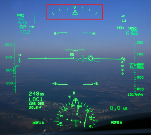
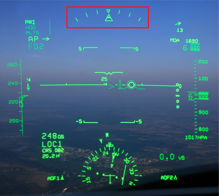
Correct, because the active mode is ALT (which means altitude hold). However, your airspeed could be a factor here, because at this altitude 220 kts is a bit low. And at low speeds the AS CRJ tends to descend by itself.
BTW, your video shows another bug of the addon: Since your current altitude differs from the selected one, ALTS should be displayed as armed mode.
-
Hi Thomas,
the MMP6S SID itself is a little tricky. The first two waypoints are basically altitude restrictions, that must be met before initiating the following turn. On the other hand, the aircraft has to perform a heading change with a total of 80° within the first 1,500 ft of climb. All this works best when the inital part of the SID is flown manually. By the way, the interruptions in the course line on the MFD map result from the fact that the turn radius is dependent on factors such as weather, aircraft performance and airspeed - AFAIK, the FMS is not capable of displaying such a dynamic course line.
Two bugs in the AS CRJ's FMS complicate matters a bit more: When the aircraft passes a waypoint with a slight deviation, the Course Pointer rotates 180° (like an ADF needle) and continues to point to the passed waypoint before eventually jumping to the next one. The same happens when passing the second waypoint and the following intercept is imminent. But what is even worse now: Course Pointer and Flight Director do not show the direction respectively steering commands for this intercept. Guidance resumes only AFTER the aircraft has been brought onto the correct course. So, you have to anticipate this course change - if you wait too long, you will miss the small slot in which the FMS (AS CRJ) is able to follow the correct course.
In summary, I would advise you to select SPEED and NAV mode shortly after gear up and then soon initiate a manually flown and almost continuous right turn onto track 036°. You don't need to focus on the FMS during this time, because it doesn't show anything reasonable and needs a while to recover. Once you are on track 036° with the course pointer eventually pointing in this direction, make sure NAV mode ist active (FMS green on PFD), then you could switch on the AP.
I hope this is somewhat helpful.
-
 4
4
-
-
11 hours ago, zenit_swe said:
Just curious, do the CRJ actually have a ground radar or is it, like in the 737, an built-in terrain database?
It's a database stored within the EGPWS. It contains a worldwide set of terrain features, obstacles and hardsurfaced runways with a length > 3.500 ft. The EGPWS computer permanently compares the actual aircraft position with the database and calculates terrain clearance envelopes ahead of the aircraft.
In addition there are two radar based navigation aids:
- the radar altimeter
- the map mode of the WX radar for ground targets
-
 2
2
-
 1
1
-
1
-
1 hour ago, SimWare said:
Both the rudder and the nose wheel are controlled separately.
Thanks. Is there a way to have
- full authority (80° either side) on the tiller and
- a small amount (8° either side) on the rudder pedals?
Because that would be the RW behaviour ...
-
1
-
@SimWare I just came across your tutorial below. Does this remove the nosewheel steering authority from the rudder pedals completely?
-
On 4/25/2022 at 11:04 PM, rbringh said:
the ratio of projected image size to combiner size should not change
But it does.
Have a look at the video below. Unfortunately with poor quality, but it is only to show collimation with the infinite focus: As the camera moves back and forth, the displayed image always remains the same size.
This causes certain limitations: At too great a distance, the content will be cropped by the edges of the combiner. Getting closer to the combiner has the opposite effect - but your head would soon block the projection beam.
IRL, this results in a rather small "Eye Box", which is why I keep repeating that there is only ONE correct seating position with this system.
-
2
-
-
One problem with the HGS is that the symbols are displayed incorrectly relative to the seating position. This was already reported a while back:
IRL, there is only one correct seating position, which must be adjusted with the help of the "Eye Reference Point" and even in this optimal position, head movements are only possible to a very small extent - otherwise the symbols would start to disappear, because both the size of the combiner and the capabilities of the projector are limited.
-
I have taken to always logging tickets in addition to my reports on the forum and I have been assured that while the tickets themselves will eventually be closed, my findings will be added to the tracking list.
-
2 hours ago, creader932 said:
On the CRJ, how do I go about entering North Atlantic Track waypoints into the FMS?
Although I doubt it is implemented it would be as follows:
The scratchpad entry format (N or S)DDMM.MM(W or E)DDDMM.MM is used for a latitude/longitude-based waypoint. The hemispheric designation (N/S, E/W) must always precede the coordinates. The coordinates are entered with the standard of four digits for latitude and five digits for longitude. If waypoint coordinates are in whole degrees of latitude, longitude or both, the minutes do not have to be entered (for example, N40, S09, W030, or E042).
For your first example you would have to enter: N48W050
-
2 hours ago, CRJay said:
I would propose that the problem is not that you produce other products, but that you seem to rely on a single key developer for multiple products. Meaning one product like the CRJ is left in what I would describe as a fairly bug-riddled state by choice, while said single developer is off working on multiple other projects. Note that I am not saying it is unusable, but it is just not what it was claimed to be. Even 'normal ops simulation' is not quite possible and will have you encounter multiple issues. Add a lack of communication on top of that and it is just not a very good customer experience.
We are closing in on the anniversary of the CRJ for MSFS, but unfortunately also on the anniversary of some of the open issues of the CRJ for MSFS. And that is very disappointing.
I totally agree.
-
@CoffeeClay FYI, the problem could have been triggered when you deleted the DISCONTINUITY. The FMS of the AS CRJ creates a "bad course line" or "ghost waypoint" when deleting the last entry of a route. It is not a specific waypoint but a course line to nowhere - in your case 359° and 3239 NM (see your video at 2:44). This is a bug that I have already reported to the AS Reps with this thread. In my experience, such a ghost waypoint has a corrupting effect on all subsequent entries.
-
1
-
-
Dear AS Reps/Devs,
since you never responded to this report, I would like to know:
Can you confirm that
- you are able to reproduce this bug?
- this is is on your bug tracking list?
-
1
-
2
-

-
1
-
4
-
-
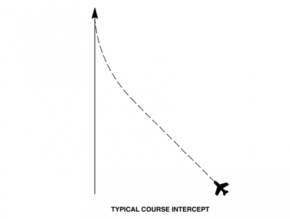
The real aircraft handles course intercepts very well. Most wobbles are rather pilot induced e.g. when changing from HDG mode to NAV. In fact we often prefer the FMS over the APP mode for intercepts of the final approach course, because of the poor gain performance of the latter.
The following is an excerpt from the FMS-4200 Pilots Guide:
Turns
The FMS computes a turn to be accomplished using a nearly constant bank angle. For small turns, the amount of bank angle is small. The larger the turn, the greater the bank angle. It also computes when to start a turn based on the type of waypoint, the number of degrees of turn, the airplane’s true airspeed, the current heading relative to the new heading, and the wind conditions. During a turn, the FMS continuously computes the bank angle to compensate for changes in wind conditions, true airspeed, and the airplane’s heading relative to the new course. Bank Angle and Roll Rate Bank angle and roll rate for a turn are continuously computed by the FMS with consideration for the flight control system's bank angle limits. With the flight control system set to the normal operation mode (no bank limit selected), the bank angle is limited to approximately 25 degrees. With the flight control system set to the HALF-BANK mode, the bank angle is limited to approximately 12.5 degrees. Roll rate is set at three degrees per second for all turns.
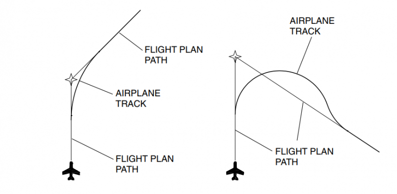
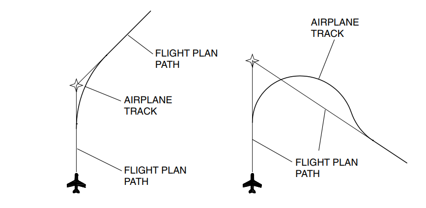
Anticipation
As the airplane approaches a turn at a waypoint, in addition to computing the bank angle for the turn, the FMS computes the point at which the turn is to be initiated. This is called turn anticipation. Its purpose is to prevent the airplane from unnecessarily overshooting the new course during the turn. Essentially, the FMS cuts the corner of the turn to make a smooth transition to the new course. For flight plan leg turns at true airspeeds less than 350 knots, the turn initiation point is not further than seven nautical miles from the waypoint. At true airspeeds of 350 knots or greater, the turn initiation limit is no further than 12 nautical miles from the waypoint. A waypoint alert flashes the active waypoint identifier on the PFD display, and the active waypoint symbol and identifier on the MFD map appear approximately five seconds before the FMS initiates the turn to the new course. While turn anticipation prevents most overshoots, very large course changes may still result in some overshoot.
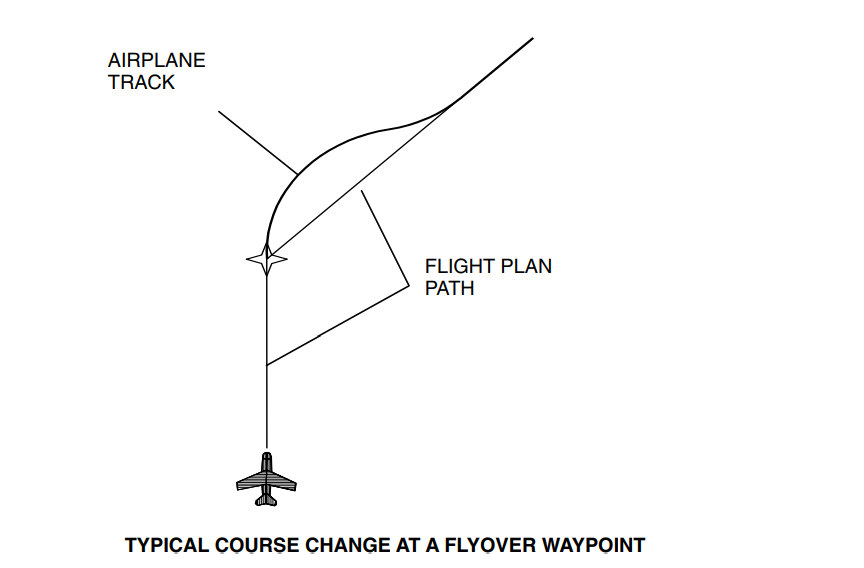
Flyover Waypoints
Selective waypoints designated as flyover waypoints require the airplane to fly over the waypoint before a turn is initiated. Examples include leg terminating waypoints such as a waypoint before a discontinuity, holding fix waypoints, and the last waypoint at the end of a flight plan.

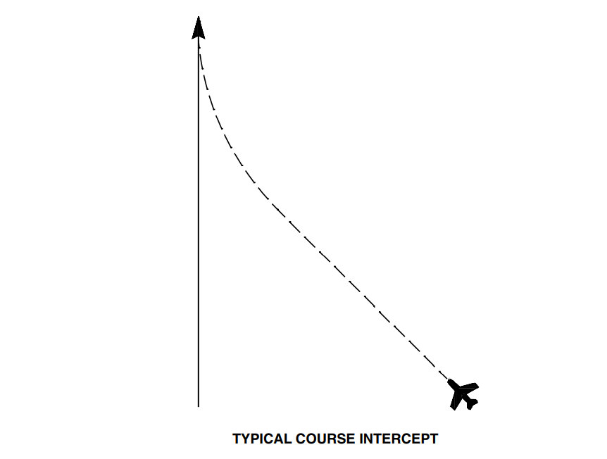
Intercepting a Track
The FMS can intercept an active course track at any converging angle. Whenever possible, the intercept is such that the airplane turns onto the active course without overshoot. However, if the intercept angle is great and the distance to the course is short, an overshoot will occur. If the intercept path is such that the intercept may not occur before the active waypoint, the message "NOT ON INTERCEPT TRK" shows on the CDU message page.
-
3
-
Autopilot Altitude Hold
in Systems
Posted
With at least FD active: When the preselected altitude does not match the current altitude, ALTS will always appear as armed mode - the only (normal OPS) exceptions to this are GS capture and go-around mode. You then have two choices: